Monte Rosa Massif
Climb to Pointe Dufour
Technical lev. : 5 / 5
You have a high level of proficiency in mountain climbing, progression and rescue techniques. You're comfortable with aerial passages on ridges. You've already done a 4000m climb and it went very well.
Physical lev. : 5 / 5
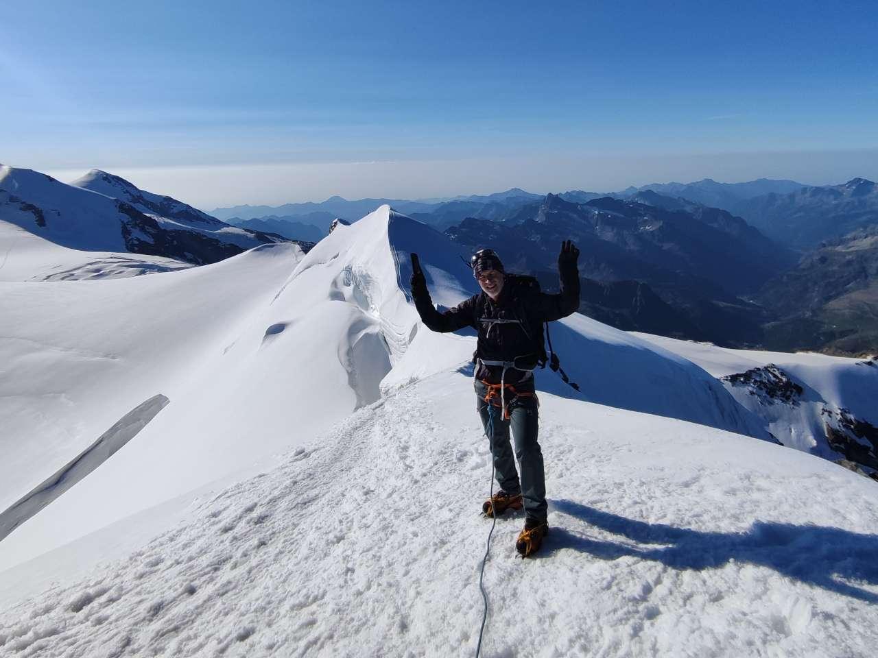
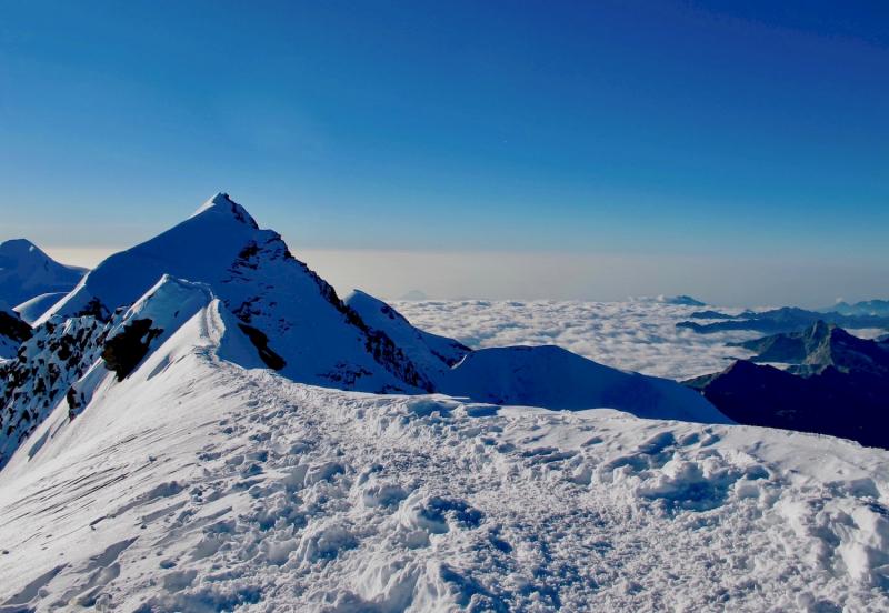
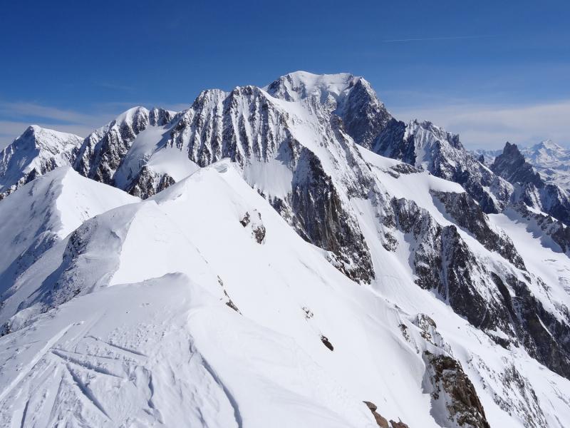
At 4,634 metres, Pointe Dufour is the highest peak in Switzerland and the entire German-speaking region. Located in the Valais Alps, it is part of the Mont Rose massif. This long and demanding route represents a real challenge for mountaineers. The climb requires meticulous preparation, excellent physical condition and advanced technical mountaineering skills. The changing weather conditions and difficult terrain add to the complexity of this climb.
Dates & Prices
 Discount if booked 4 months before departure
Dates available on request. Contact us at info@espritmontagne.com.
Journey
The second highest peak in the Alps was renamed in 1863 by the Swiss Federal Council in honour of Swiss general and cartographer Guillaume-Henri Dufour (1787-1875). Dufour is famous for having edited the first series of accurate maps of Switzerland, known as the Dufour map, which has become a benchmark in the field of cartography. In recognition of his outstanding contributions, the summit was named Pointe Dufour in his honour, perpetuating his legacy and contribution to the cartography and geographical recognition of Switzerland.
Program
Elevation gain/loss: + 600 m / - 500 m
Duration: between 3 and 4 hours
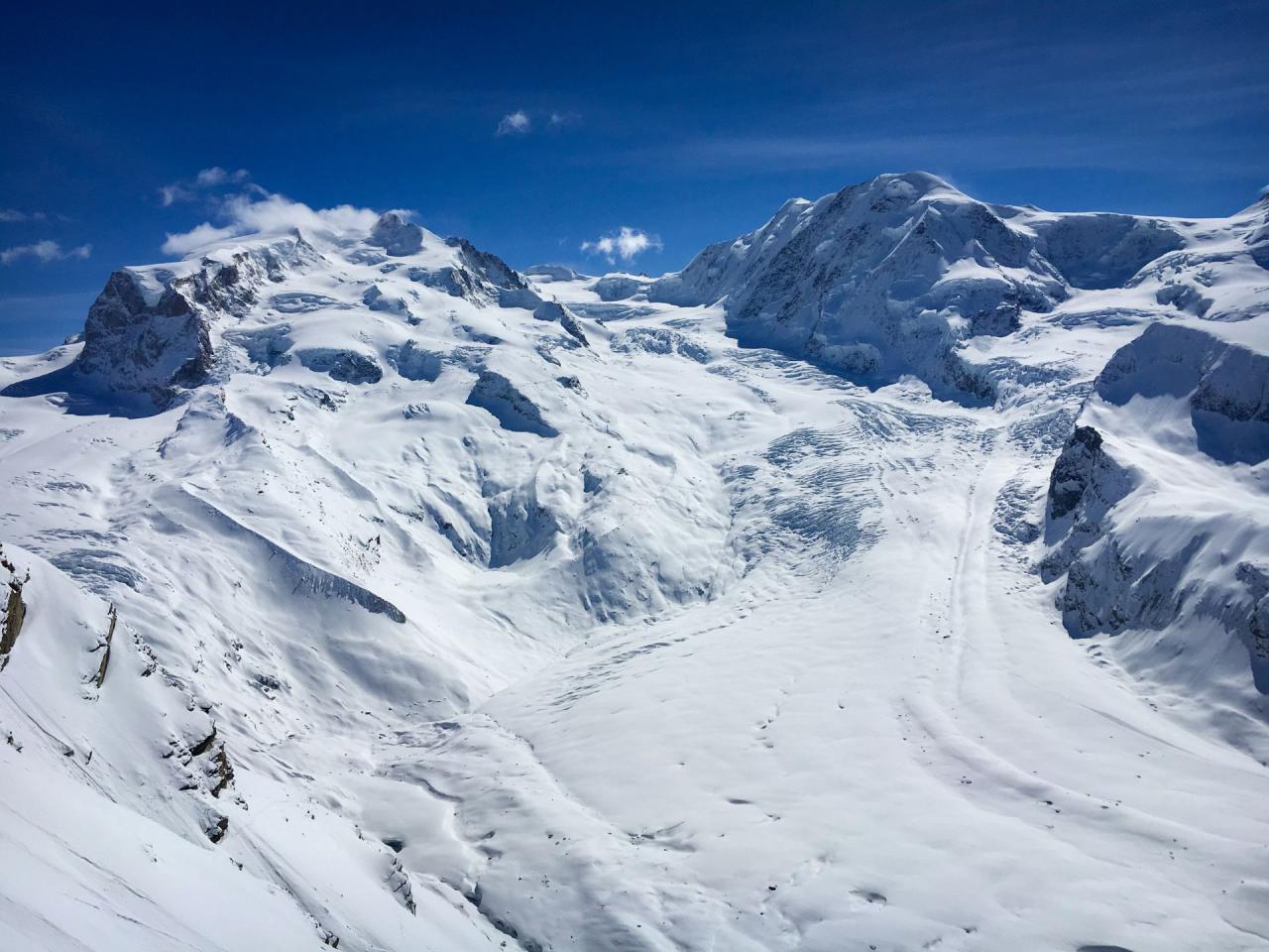
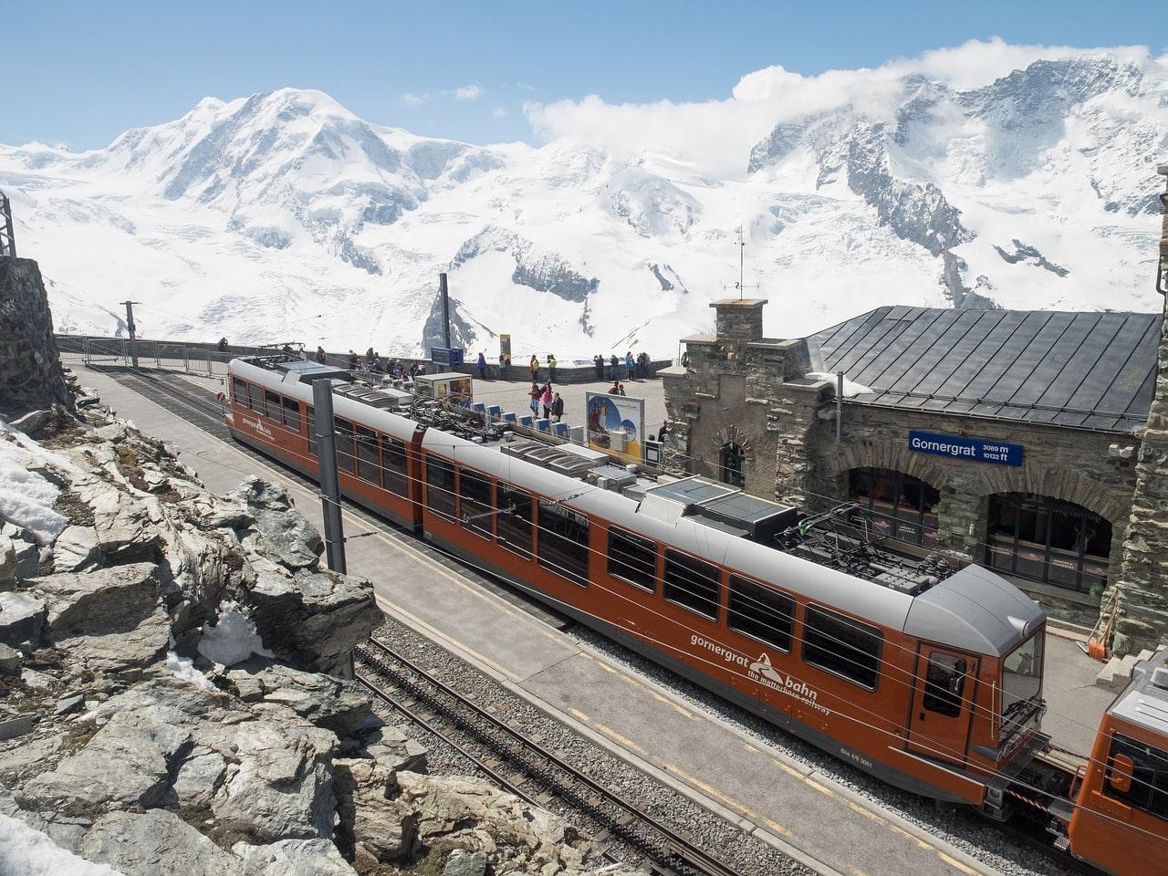
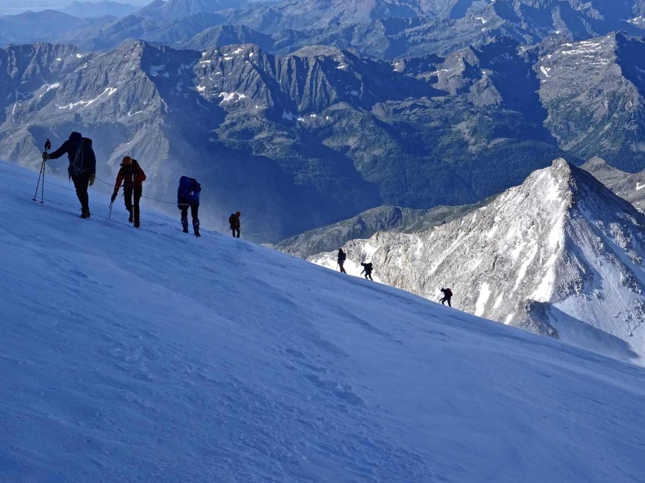
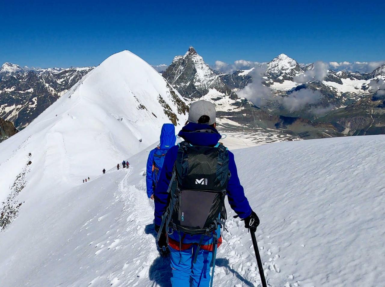
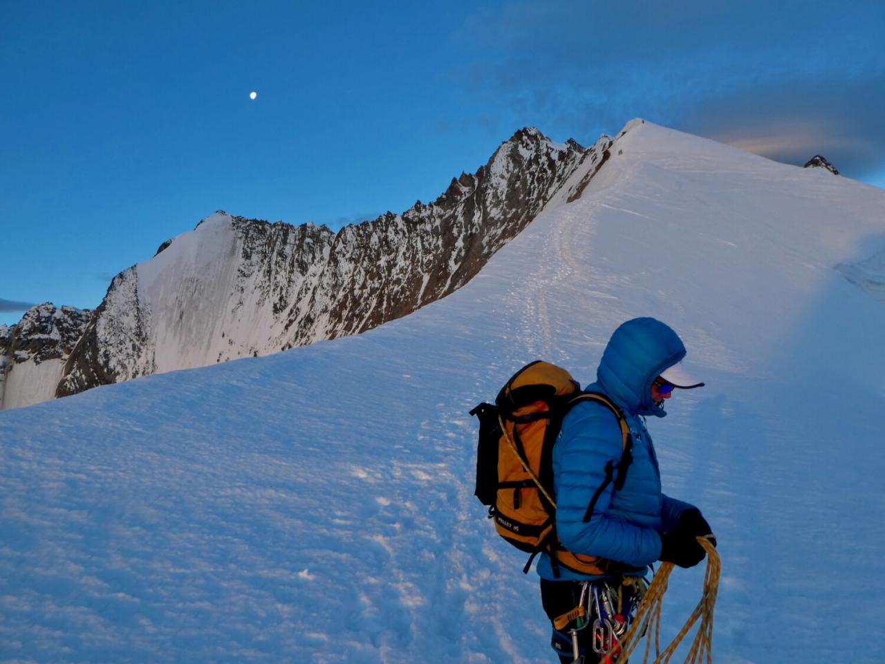
The meeting point with the guide is the Gornergrat train station in Zermatt. We'll take the cogwheel train up to Rotenboden station (2,815 metres). The view from here is breathtaking, not only of the Monte Rosa massif, but also of the majestic Matterhorn. We'll start on the path that takes us over the Gorner glacier (Gornersee), where we'll already need crampons. After a sustained climb, during which the refuge alternately appears and disappears, we'll discover the Monterosa Hutte, where we'll be spending the next two nights.
Elevation gain/loss: + 1800 m / - 1800 m
Duration: between 11 and 12 hours
Elevation gain/loss: + 500 m / - 600 m
Duration: between 3 and 4 hours
The third day of this trip is dedicated to the descent to Zermatt, where we will arrive by taking the Gornergrat train from Rotenboden station (2,815 metres). We may feel a little tired as we climb back up the slope to the train station, but the joy and unique beauty of these landscapes will give us the motivation to keep going. Once the train has reached its destination, the group will be dispersed in Zermatt.
Equipment
First layer on the skin - underwear:
Second layer:
Third layer:
Last layer:
Do not forget:
If you have any doubts or simply need clarification on what equipment to take for your climb, you can take a look at our Blog page ‘What equipment for mountaineering?’
IMPORTANT: if a person is not properly equipped and dressed, the mountain guide may decide not to allow him/her to take part in the climb. We ask you to read carefully the list of equipment detailed in the PDF program of the tour and to call us if you have any doubts.
Level
TOP-LEVEL SPORTSMAN :
EXPERT MOUNTAINEERING :
You have a high level of proficiency in mountain climbing, progression and rescue techniques. You're comfortable with aerial passages on ridges. You've already done a 4000m climb and it went very well.
Useful information
Meet the guide in Zermatt on DAY 1.
The group leaves Zermatt in the afternoon of the third day between 14:00 and 16:00.
The week before your departure, you will receive a reminder by email with all the information concerning the meeting point and the guide in charge of your group. Esprit Montagne / Esprit des Guides SA will take care of booking the hut, so you don't have to worry about it.
French ans English-speaking UIAGM mountain guide in our team.
If the mountain or weather conditions do not allow the ascent to be made as planned, an alternative program of ascent will be proposed wherever possible, the price will be adjusted accordingly and the guide's days will not be cancelled.
If you need to hire technical equipment (crampons, harness and ice axe), let us know in advance: it is possible to arrange hire with your guide.
Regarding mountaineering boots, here is the type of boots you should have: Scarpa Triolet GTX
You can rent them at Gal Sport in Aosta, at the Pilier du Sport in Morgex (AO) or at Ravanel or Snell in Chamonix.
Italy is in the Eurozone, so the currency is the Euro (€).
The shelter has a credit card terminal, however, we strongly advise you to bring cash!
Be aware of the usual bank charges when purchasing goods or services with your credit card.
To confirm your booking, you need to :
The balance is due 60 days before the start of the course.
. Guiding from an experienced mountain guide in our team (one guide = one client) ;
. Use of group equipment (ropes, pitons, carabiners) ;
. Half-board at the Monterosa-Hütte refuge for you and the guide on days 1 and 2 ;
. Tickets for the cable car to Zermatt (Gornergrat train to Roteboden station) - return ticket.
. Personal technical equipment: crampons, harness and ice axe (if you need to hire, let us know) ;
. Lunches, drinks and personal expenses ;
. Transfer to Zermatt ;
. Everything not explicitly mentioned in the ‘Price includes’ section.
Photo gallery


You will also love

5 days
2580
.jpg)
4 days & 3 nights
1730

3 days & 2 nights
1730

4 days & 4 nights
1000
2 days & 1 Nights
530
2 days
260

2 days
550
2 days & 1 night
490

4 days & 3 nights
980
2 days
620

4 days & 3 nights or 5 days & 4 nights
1770
3 days and 2 nights
1350
2 days
810
2 days
810

3 days & 2 nights
1280
2 days & 1 night
970
3 days and 2 nights
2850
3 days & 2 nights
660
4 days & 3 nights
1050
The Pointe Dufour, Switzerland's highest point in the Mont Rose massif, reaches an altitude of 4,634 metres. It is the country's highest peak and the second highest in the Alps after Mont Blanc. It lies to the south-east of the canton of Valais, above the Zermatt valley, on the Mont Rose ridge line.
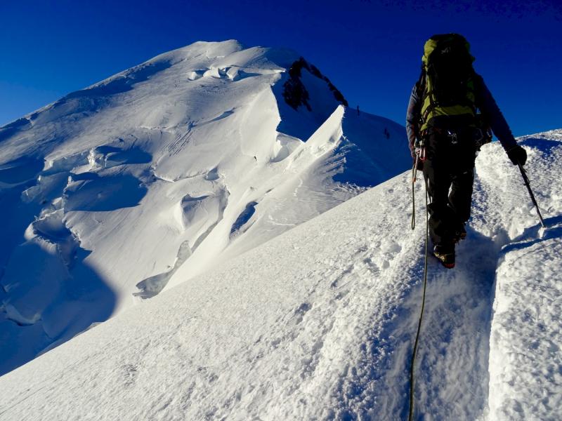
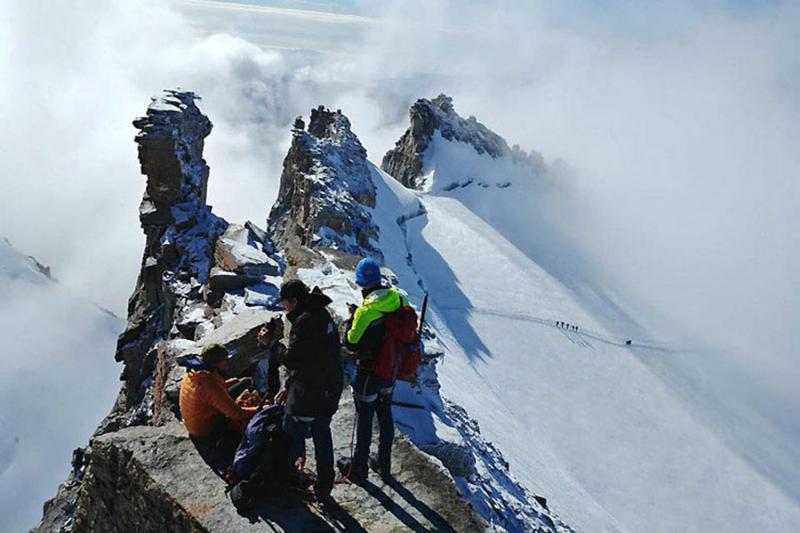
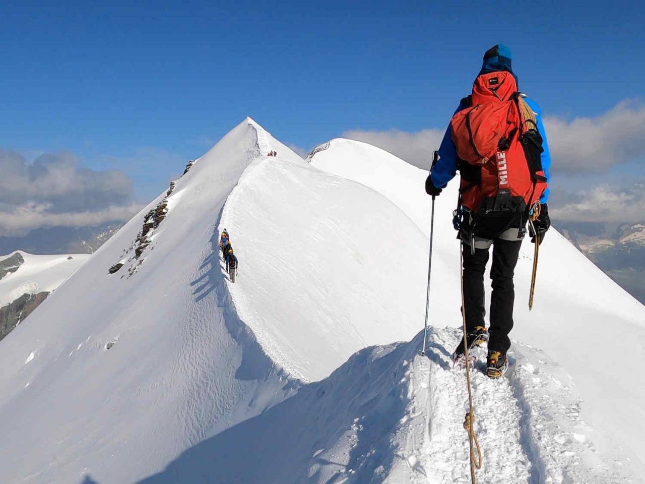
The ascent of Pointe Dufour is a route for experienced mountaineers. The terrain is mixed, with slopes approaching 50 degrees and passages of III-IV rock. This race therefore requires versatility to adapt quickly to different snow or rock terrain, and ease on aerial passages.
To prepare for the ascent of Pointe Dufour/Dufourspitze, we recommend, for example, climbing the Nez du Lyskamm, or doing a traverse of Mont Rose - Spaghetti tour beforehand.
Pointe Dufour or Dufourspitze is best climbed in summer, from July to August. As this route is partly on rock, unlike the ascent of Mont-Blanc and the Matterhorn, it is necessary to wait until the rock passages are relatively dry.
The highest peak entirely in Switzerland is the Pointe Dufour, which rises to 4,634 metres. It is part of the Mont Rose massif in the Valais Alps, close to the border with Italy. Pointe Dufour is named in honour of Guillaume-Henri Dufour, a famous Swiss engineer and cartographer.
This majestic peak attracts climbers from all over the world because of its technical challenges and spectacular panoramas. The ascent of Pointe Dufour is demanding, requiring good physical condition and solid mountaineering experience, as it traverses glaciers and steep terrain. The classic start is often from Zermatt, an emblematic village in the Valais.
As well as its sporting appeal, the Pointe Dufour is a symbol of Switzerland's natural beauty and alpine prowess, embodying the country's mountain spirit.
Yes, it is possible to climb Lyskamm (4,533 m) and Punta Dufour (4,634 m) in one go, but this route is reserved for very experienced mountaineers. These two peaks are part of the Mont Rose massif, and linking them together is a technical and physically demanding adventure. Esprit Montagne suggests a 2-day ascent of the Nez du Lyskamm, one of the most beautiful peaks in the Alps.
The classic route often starts at the Quintino Sella hut or the Cabane du Mont Rose, depending on the approach you choose. Climbing the Lyskamm involves crossing narrow, exposed ridges, sometimes nicknamed the ‘man-eater’ because of the unstable snow conditions. After the Lyskamm, climbers continue towards the Pointe Dufour, crossing crevassed glaciers and steep slopes.
This sequence requires excellent acclimatisation to the altitude, mastery of ice climbing techniques and perfect weather conditions. It's a prestigious challenge, offering spectacular views of the Valais Alps.
The best time to climb Mont Rose is from mid-June to mid-September, during the summer season. During this period, weather conditions are generally more stable, and temperatures, although cooler at higher altitudes, are milder. The glaciers are also less crevassed thanks to the accumulation of winter snow.
At the start of the season (June-July), glacier conditions are often better, with stronger snow bridges and more uniform snow cover. However, the cold mornings mean that you need to leave very early to avoid the risks associated with thawing during the day. In August and early September, conditions remain favourable, but the melting of the glaciers can make certain sections more technical or exposed.
It is important to follow the weather forecasts closely and to be accompanied by a guide if you lack mountaineering experience, as the ascent of Mont Rose remains demanding and technical.
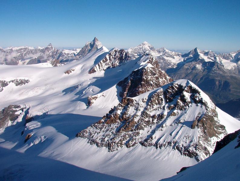
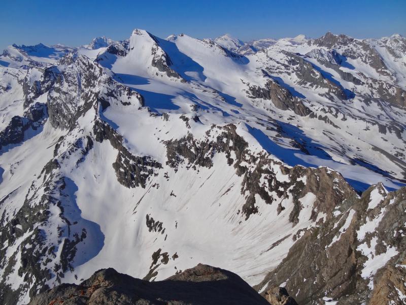
Mont Rose rises to an altitude of 4,634 metres, its highest point being the Pointe Dufour, the highest peak entirely in Switzerland. Located in the Valais Alps, close to the Italian border, the Mont Rose massif is the second highest massif in the Alps after Mont Blanc. It includes several peaks in excess of 4,000 metres, such as the Liskamm, the Pointe Gnifetti (4,554 m) and the Zumsteinspitze (4,563 m).
Mont Rose is renowned for its spectacular glacial scenery and access to numerous mountain huts, including the famous Cabane du Mont Rose (2,883 m). These impressive altitudes attract mountaineers and high-mountain enthusiasts from all over the world. Climbing the various peaks of Mont Rose is a technical and physical challenge, offering exceptional panoramic views of the Swiss and Italian Alps.
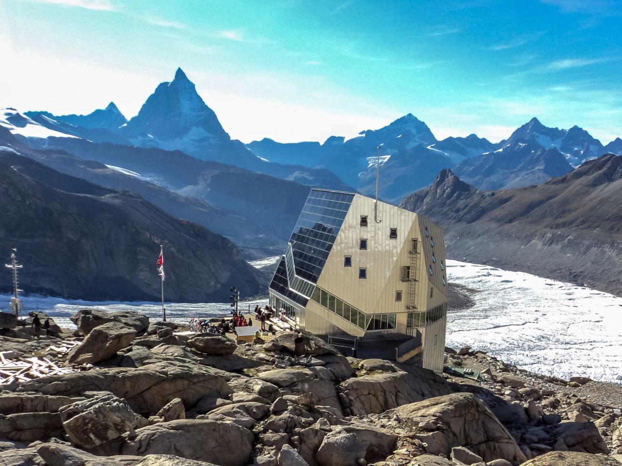
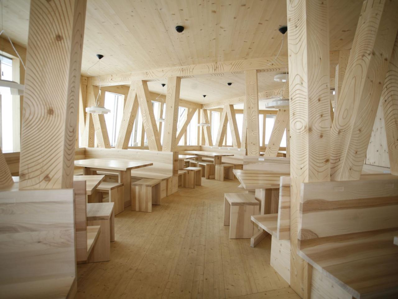
The ascent of Pointe Dufour (4,634 m) is generally made via the Monte RosaHut( Cabane du Mont Rose ), situated at an altitude of 2,883 metres. This modern, well-equipped hut can be reached from Zermatt by taking the cable car up to Klein Matterhorn or Riffelberg, followed by an approach walk across the Gorner glacier. It was renovated and rebuilt in 2009 and can accommodate up to 120 people, and boasts futuristic architecture.
The Cabane du Mont Rose is the starting point for the classic route to the Pointe Dufour. The route crosses crevassed glaciers, in particular the Gorner glacier and the Grenzgletscher, before beginning a more technical ascent on the summit slope. An alternative approach is the Cabane Margherita (4,554m), but this is on the Italian side and involves a different route.
This long and demanding ascent requires a very early start (often around 2-3am) to take advantage of the stable glacial conditions.
The first ascent of Pointe Dufour took place on 1 August 1855. This historic expedition was led by a team made up of the British mountaineer Charles Hudson, his compatriot John Birkbeck, the Swiss guide Johann Madutz and the brothers Matthäus and Johannes Zumtaugwald from Zermatt.
The ascent, made from the Swiss side, marked a milestone in the history of mountaineering. At the time, climbing techniques and equipment were rudimentary, making the feat particularly remarkable. The team followed a complex route across the glaciers and ridges of the Monte Rosa massif to reach the summit.
Pointe Dufour was named in honour of Guillaume-Henri Dufour, the famous Swiss cartographer, shortly after this first ascent. Today, it remains an iconic summit, popular with mountaineers from all over the world.
Charles Hudson (1828-1865) was a renowned British mountaineer, known for his major contributions to early mountaineering in the Alps. An Anglican clergyman by profession, he distinguished himself by his many first ascents of iconic peaks.
He played a key role in the first ascent of Pointe Dufour (4,634 m) on 1 August 1855, a feat that testifies to his skill and courage in the mountains. Charles Hudson is also famous for having made the first ascent of Mont Blanc without a guide in 1855, an exceptional feat for the time.
However, he is infamous for having taken part in the first ascent of the Matterhorn (4,478 m) on 14 July 1865, which ended tragically. During the descent, a rope snapped, killing four members of the team, including Hudson himself. This landmark accident had a profound influence on the history of mountaineering, reinforcing the importance of safety in the high mountains.
Nordend is the second highest peak in the Monte Rosa massif, reaching an altitude of 4,609 metres. It lies directly to the north-east of Pointe Dufour (4,634 m), to which it is linked by a rocky glacial ridge. Both peaks lie on the border between Switzerland and Italy, but Nordend, like Pointe Dufour, is considered to be mainly on the Swiss side, in the canton of Valais.
The summit of Nordend is slightly less popular than Pointe Dufour, but offers a similar technical challenge. It is marked by steep, glaciated slopes, particularly on its northern side. The Nordend can be seen from Zermatt and other vantage points, and is often climbed via routes similar to those leading to Pointe Dufour, starting from the Cabane du Mont Rose. It is prized by mountaineers for its spectacular views and its wild character.


