Trail Running in Italy / Aosta Valley
Trail Monte Rosa Sauvage
Technical lev. : 3 / 5
EXPERT MOUNTAIN TRAIL RUNNING:
Mountain trail for experienced people, you have experience and skill in the mountains.
Some passages are vertiginous and sometimes you have to use your hands to help you progress.
Learning about the weather and cartography experience, the Guide can give you a map to learn how to manage a route if you wish!
Physical lev. : 4 / 5
VERY TRAINED SPORTS COURSE:
Effort corresponding to approximately 1500 to 2300 metres of elevation gain in trail running per day.
Perfect if you like sports!
Dates & Prices
 Discount if booked 4 months before departure
Arrival
End
Price *
Status
Du 18/08/2025 au 21/08/2025
au 21/08/2025
730.00€ 708.00€Discount if booked 4 months before departure
Bookings in progress
* Price per person (without insurance)
Trip
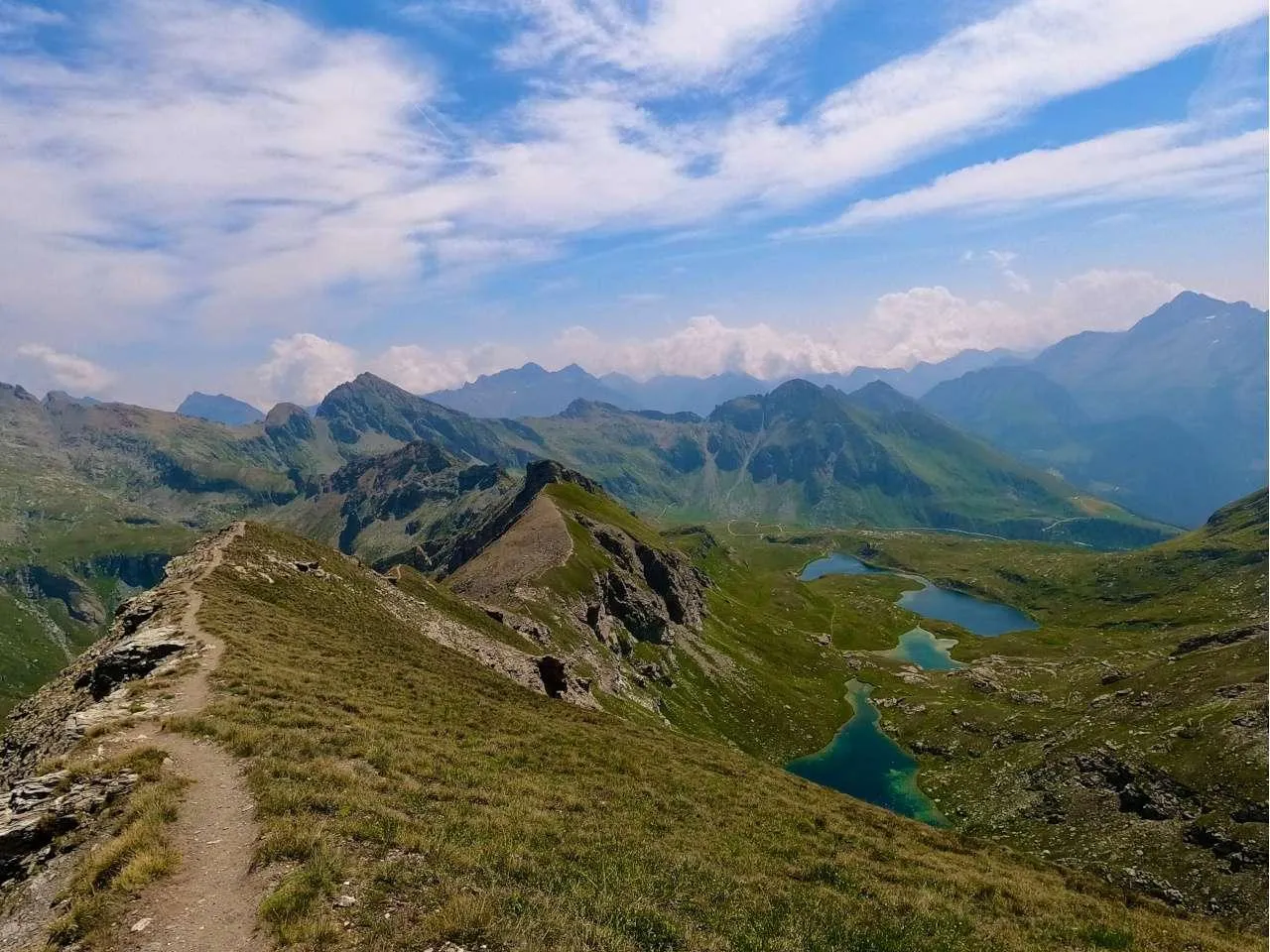
The Monte Rosa Trail offers us the opportunity to follow trails and wild paths surrounded by unique flora and fauna, in a magnificent mineral setting. Let yourself be seduced by this trail and come with us to discover this corner of the Alps, which is reminiscent of the Himalayas and the Mont Blanc massif, but without the crowds!
Program
Elevation gain: +/- 1560
Duration: approximately 6 to 7 hours
Meet in Champoluc at 8.30am to set off for the mountains, where you will meet your guide, who will brief you on the stay.
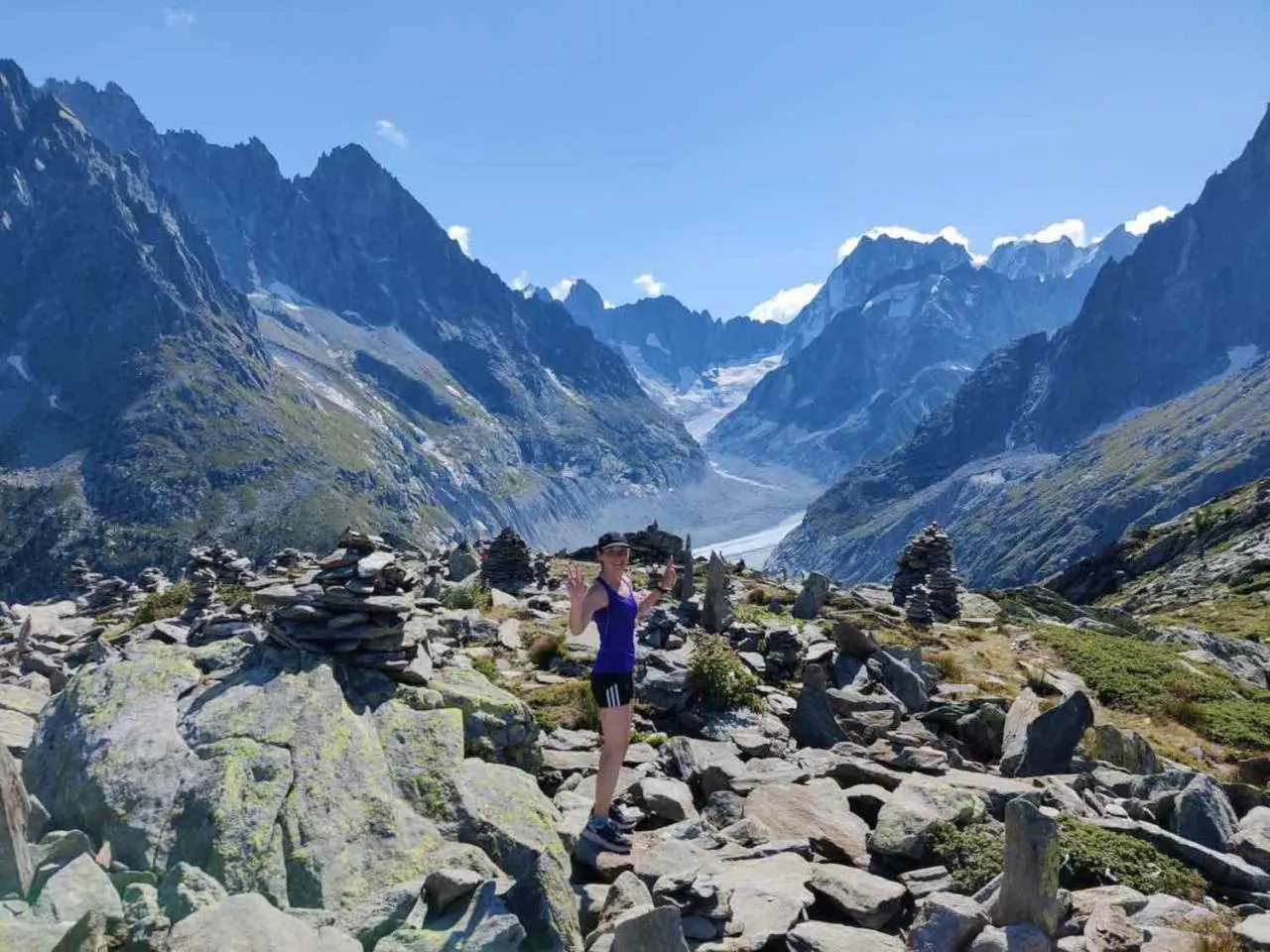
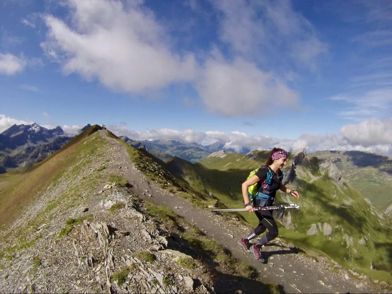
This trail day offers a spectacular loop combining technical alpine trails and magnificent panoramas. Starting from Champoluc, the route climbs gradually through larch forests before reaching the mountain pastures, where the view opens onto the Monte Rosa massif. The trail becomes steeper as you approach the summit of Becca Trecaré (3,036 m), with a final, rockier section requiring agility and endurance.
The descent, which is just as demanding, follows an alternative route that winds between ridges and valleys, before reaching green pastures where you may come across marmots and ibexes. We will arrive at our accommodation to rest.
Elevation gain: +/- 1650 m
Duration: approx. 6 to 7 hours
Today we have an exceptional route, ideal for trail runners in search of altitude and glacial landscapes. We will start the day by making a loop on the western slope of Champoluc before starting the ascent towards Rifugio Mezzalama. As soon as you leave the village, the trail climbs gradually through larch forests before reaching the vast mountain pastures of the Valle di Verra, where the first views of the Monte Rosa glacier appear.
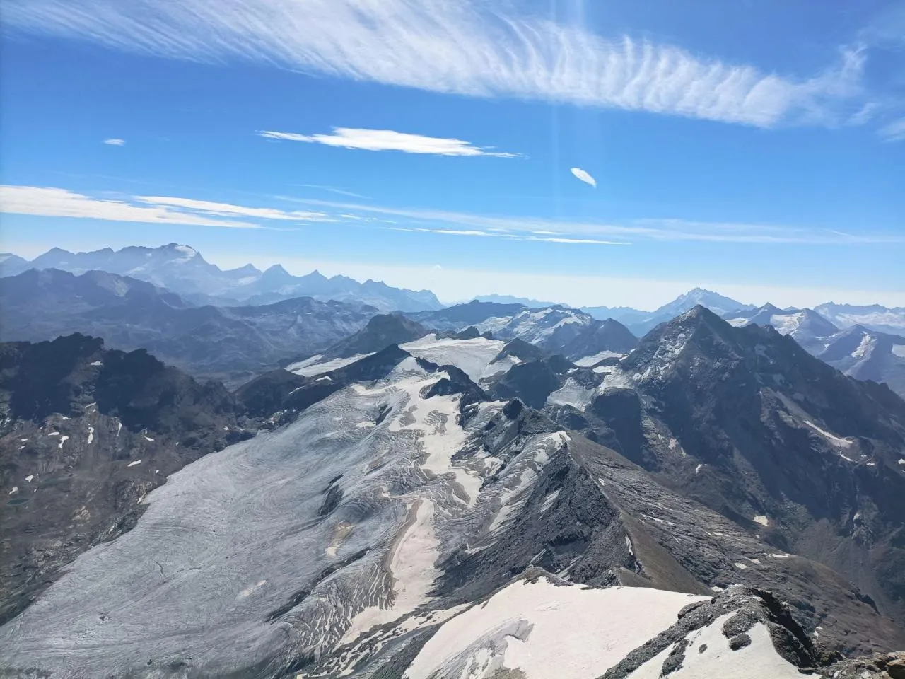
The climb becomes steeper as you pass the Rifugio Guide Frachey, before reaching the Upper Pian di Verra, a mineral plateau of striking beauty. The final ascent to the Rifugio Mezzalama (3,036 m) is along a rocky and demanding trail, with a high mountain backdrop dominated by the eternal snows and impressive seracs of the glacier.
Elevation gain: +/- 2300 m
Duration: approx. 8 to 9 hours
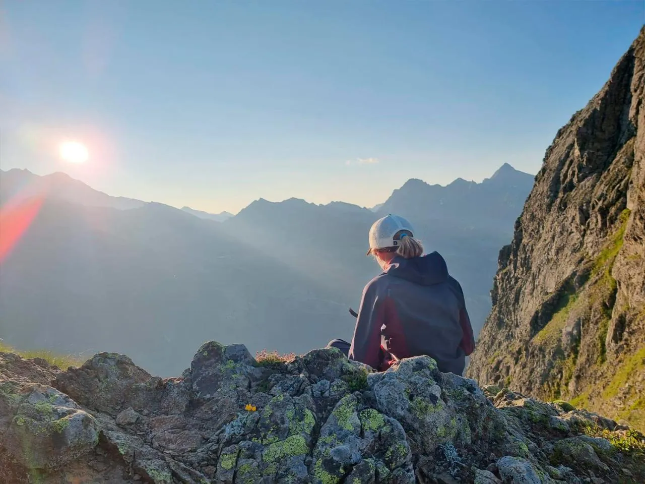
After a good breakfast, we begin this demanding day that offers total immersion in the alpine landscapes of the Val d'Ayas. As soon as you leave the village, the trail climbs through the forests, winding along the slopes to the mountain pastures of Cuneaz, a picturesque hamlet perched at an altitude of over 2,000 metres. The climb continues with a steeper slope, offering a breathtaking view of the surrounding peaks, including the majestic Matterhorn. The final stretch towards the Rothorn (3,150 m) becomes more technical, crossing scree slopes and ridges where the altitude makes itself felt, but the reward at the summit is magnificent: a 360° panorama of Monte Rosa, the Grand Combin and the neighbouring valleys.
The descent follows a different route, reaching the vast alpine meadows before returning to the more rolling paths leading to our accommodation.
Elevation gain: +/- 1670 m
Duration: approximately 7 to 9 hours
For this last day, we have a route that is as spectacular as ever. From the start, the trail climbs gradually, offering a steady and pleasant ascent to the mountain pastures of Mascognaz, a typical hamlet nestled at an altitude of over 1,800 metres. From there, the route becomes wilder, crossing grassy slopes and scree before reaching the Colle della Battaglia (2,657 m), which marks the entrance to a mineral and unspoilt world. The crystal-clear Lac de la Bataille then appears in a grandiose setting, surrounded by imposing peaks and offering a breathtaking view of Monte Rosa and the surrounding valleys.
The descent follows an alternative route, allowing you to vary the landscapes by reaching the valleys of the Ayas Valley before plunging back into the forest towards Champoluc. Some rolling sections allow you to speed up, while the more technical parts require agility and concentration.
We can share a drink together in Champoluc before parting ways and going our separate ways.
Materiel
Allow 2 litres of water and 500 grams of food for the day.
Your guide will have a more comprehensive first aid kit in case of a more serious accident.
Weight is the trailer's enemy, but a frozen or soaked trailer is a trailer without pleasure!
So take the time to prepare your rucksack well and weigh it before leaving to check that without water or food your bag weighs 3 to 4 KG but no more!
Level
VERY TRAINED SPORTS COURSE:
Effort corresponding to approximately 1500 to 2300 metres of elevation gain in trail running per day.
Perfect if you like sports!
EXPERT MOUNTAIN TRAIL RUNNING:
Mountain trail for experienced people, you have experience and skill in the mountains.
Some passages are vertiginous and sometimes you have to use your hands to help you progress.
Learning about the weather and cartography experience, the Guide can give you a map to learn how to manage a route if you wish!
Useful infos
Meet in Champoluc, the last inhabited hamlet at the foot of Monte Rosa, at a car park free of charge.
Click on the map below to view the point on Google Maps:
Group dispersal on D4 at the end of the day around 16:00 in Champoluc (Aosta Valley).
Cancellation and repatriation insurance is compulsory, as well as another insurance policy covering mountain search and rescue (approximately 10,000 Euros cover).
Here is the insurance that Esprit Montagne offers: https://www.assurance-multi-sports.com.
France and Italy are in the Euro Zone, so the currency is the Euro (€).
The refuge also has an electronic payment terminal, but we strongly advise you to bring cash!
When you register online, you can choose whether or not you would like to car-share to get to the starting point of your course. After you have made your booking, when you log back into your personal Esprit Montagne account, a section dedicated to car-sharing will be available. You will find the contact details of other participants on your course who are interested in car-sharing, allowing you to get in touch with them directly.
. Guidance from a state-qualified mountain leader from our team.
. Half-board accommodation in a refuge.
. Picnics on days 2, 3 and 4.
. The compulsory transport in the program of activities.
. Video support to help you progress and improve your technique
. Theoretical input on mountain running with an explanation of Dynamic Joint Stacking (DJS) techniques - your guides have been trained with Fred Brigaud, osteopath and trail running specialist.
. Photo/video pack of the technical workshops
. Cancellation/interruption of stay/loss of luggage insurance and emergency assistance.
. Picnic on day 1.
. Drinks and personal expenses.
. Tips.
. Anything not indicated in the ‘Price includes’ section
Photo gallery


You will also love
4 days & 3 nights
540
4 days & 4 nights
640
4 days & 3 nights
630
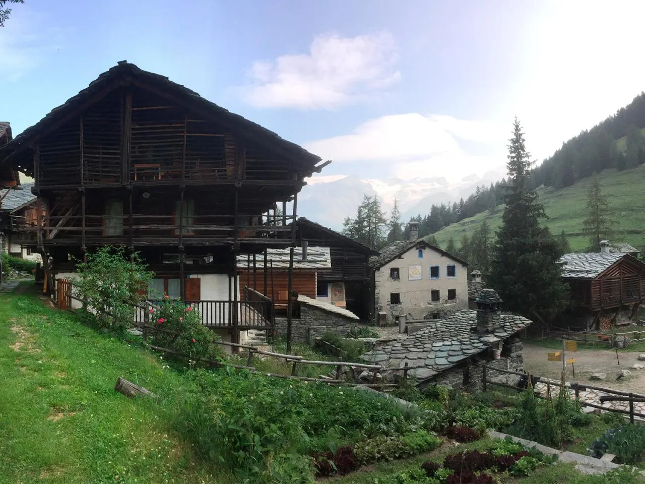
The Walser Valley, located in the Aosta Valley, is a unique territory where nature and Alpine traditions blend harmoniously. Populated since the Middle Ages by the Walsers, a community of Germanic origin, this valley has preserved its identity through its typical architecture, dialects and ancestral customs. There are magnificent villages with wooden and stone chalets, built using traditional techniques adapted to the rigours of the altitude.
Today, the Walser Valley is a paradise for mountain lovers, offering a multitude of hikes, trails and alpine routes in the heart of grandiose landscapes dominated by Monte Rosa. Far from mass tourism, it invites you to immerse yourself in unspoilt nature, among larch forests, green mountain pastures and glacial panoramas. A true witness to a fascinating past, it appeals as much to the culturally passionate as to adventurers in search of the great outdoors.
The biggest trail race in France is the Ultra-Trail du Mont-Blanc (UTMB). Every year, this legendary event brings together the world's best trail runners for a race covering 171 km and 10,000 metres of elevation gain around the Mont-Blanc massif, crossing France, Italy and Switzerland. Considered one of the most prestigious and demanding events in the world, the UTMB requires intense physical and mental preparation. Its spectacular route, between technical alpine trails and grandiose landscapes, makes it an unmissable challenge for passionate ultra-trail runners.
The most difficult trail in the world is often considered to be the Barkley Marathons, a legendary and extreme race that takes place in Frozen Head State Park, in the United States. With an unmarked course of approximately 160 km and an elevation gain of over 18,000 metres, this event is renowned for its extreme difficulty. The unpredictable weather conditions, the complex orientation and the limited time to complete the five loops of the course make the race almost impossible: since its creation in 1986, fewer than 20 runners have managed to finish it. A true trail running legend, the Barkley Marathons is an ultimate challenge reserved for the most enduring and strategic runners.


