
Monte Rosa Massif
Tour of the Matterhorn
Technical lev. : 4 / 5
FAIRLY EASY MOUNTAINEERING:
You should be comfortable walking in the mountains and on varied terrain. Easy climbing. If you have already done a glacier trek, it is better, but not compulsory, if you have a good physical and mental condition. Learning the techniques of progression at altitude for fairly easy routes and easy rescue techniques.
Physical lev. : 4 / 5
SPORTY & TRAINED PEOPLE:
Effort corresponding to approximately 1200 - 1700m of ascent per day.
You like and practice endurance sports at a good level.
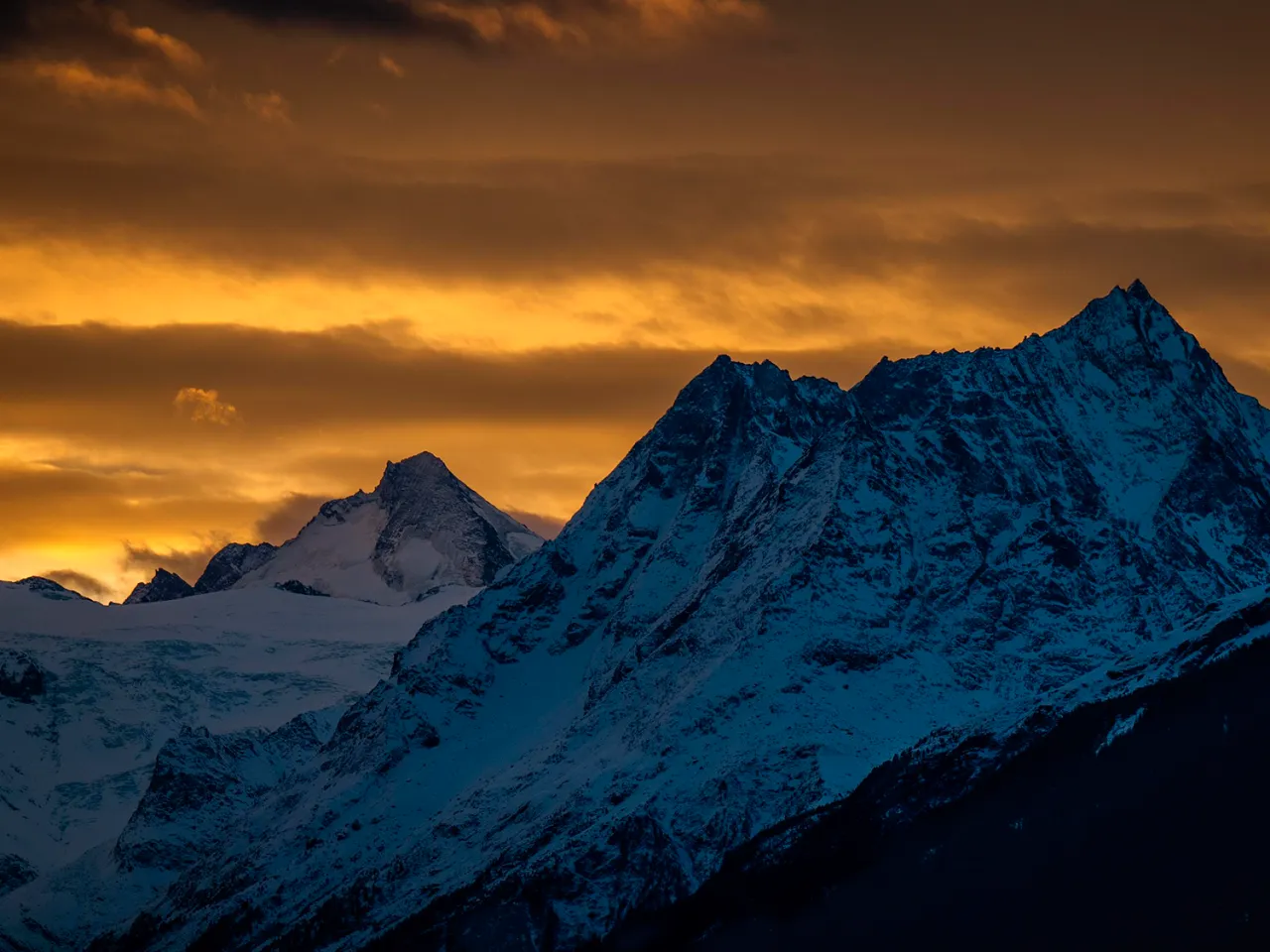
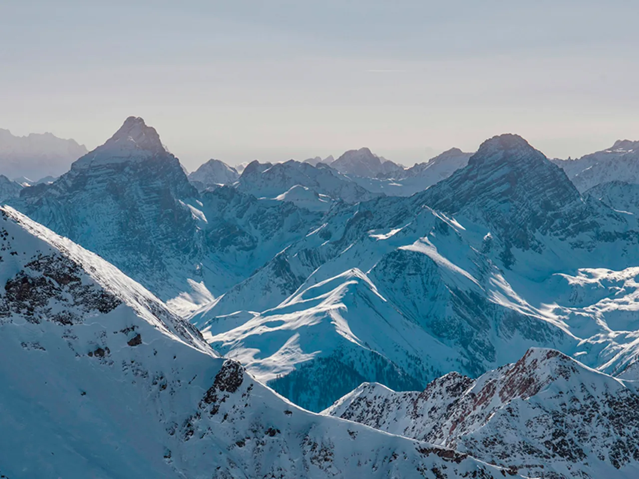
Whether you are passionate about hiking or looking for a sporting challenge, this trip around the Matterhorn (4,478 m), one of the most iconic mountains in the world, promises escape, adventure and thrills. Join us for a unique adventure, as close as you can get to the legendary peaks with this alpine trekking programme.
Dates & Prices
 Discount if booked 4 months before departure
Arrival
End
Price *
Status
Du 15/07/2025 au 20/04/2025
au 20/04/2025
1850.00€
Bookings in progress
* Price per person (without insurance)
Trip
Enjoy an unforgettable experience in the heart of the Alps with a six-day tour of the Matterhorn, starting from Zermatt. This exceptional trek will take you on a journey of discovery through spectacular landscapes, including majestic glaciers, green mountain pastures and high mountain passes offering breathtaking panoramic views. Each stage is a total immersion in the alpine world, crossing Switzerland and Italy, with stops in authentic refuges where comfort and mountain gastronomy await you.
This programme combines trekking and mountaineering to offer you a complete mountain experience in summer.
Program
Elevation gain: + 1100 m
Duration: approx. 4 to 6 hours
Meet in Zermatt at 8.30 a.m. to set off for the mountains, where you will meet your guide, who will brief you on the trip.
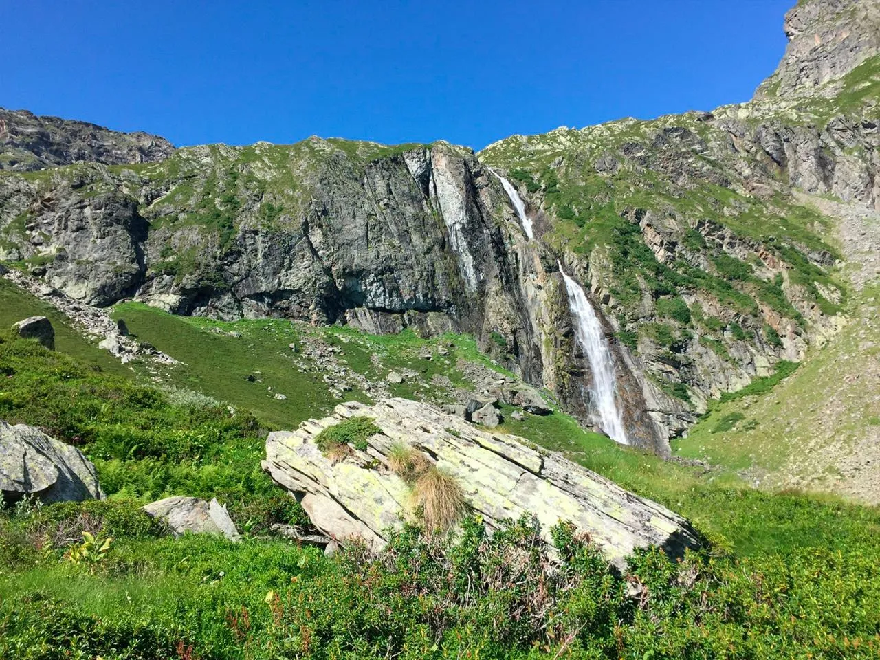
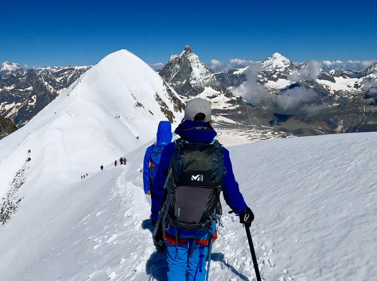
The trail starts in Zermatt and follows a gradual climb through alpine meadows and sparse forests, offering panoramic views of the snow-capped peaks. As they walk along the bottom of the Zmutt valley, hikers pass through charming hamlets and discover waterfalls fed by melting glaciers. The landscape becomes wilder as the route climbs, with breathtaking views of the Zmutt glacier and the steep walls of the Matterhorn that come closer with every step.
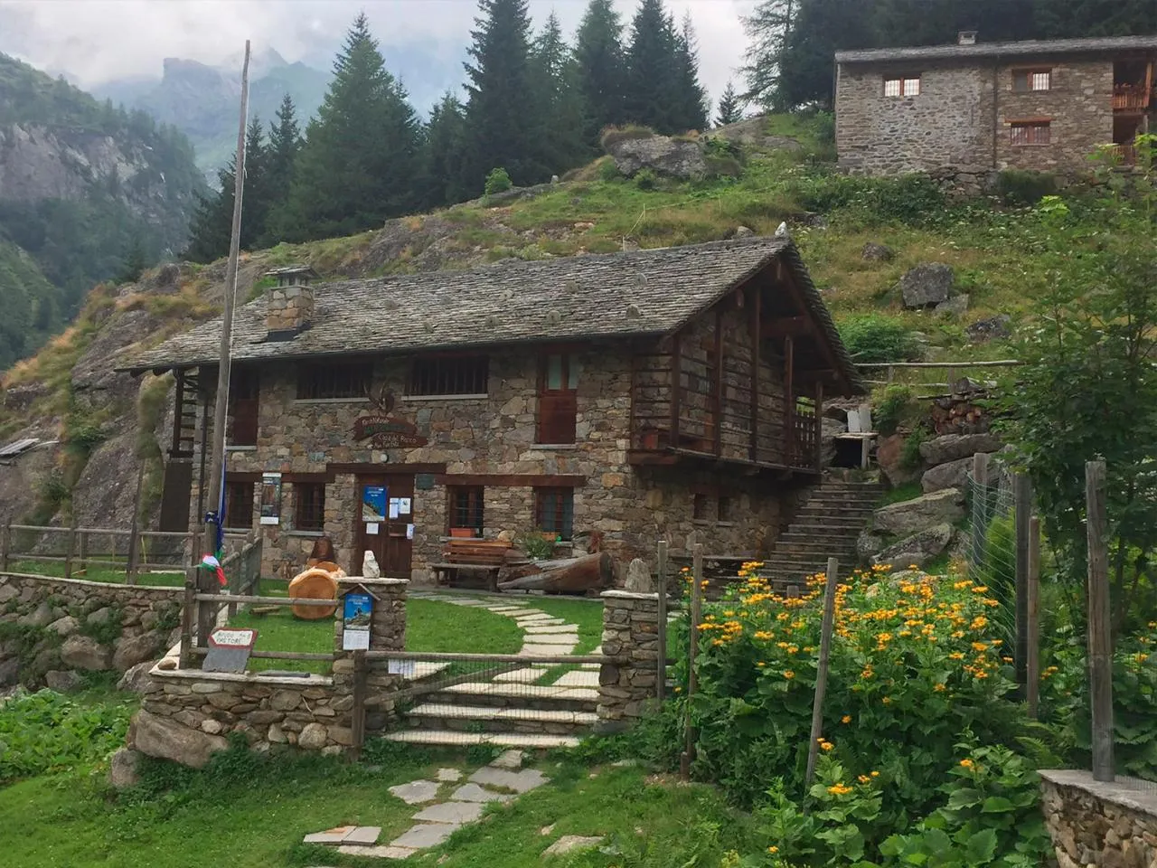
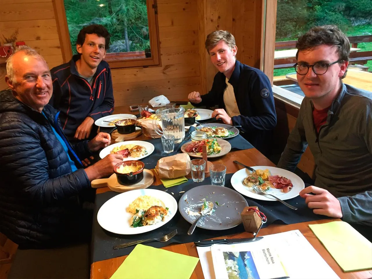
We will arrive at the mountain hut where we will spend the night. The atmosphere is friendly, conducive to exchanges between mountain enthusiasts, and you can enjoy a hot meal with a breathtaking view of the peaks.
Elevation gain: + 1400 m / - 800 m
Duration: approximately 6 to 7 hours
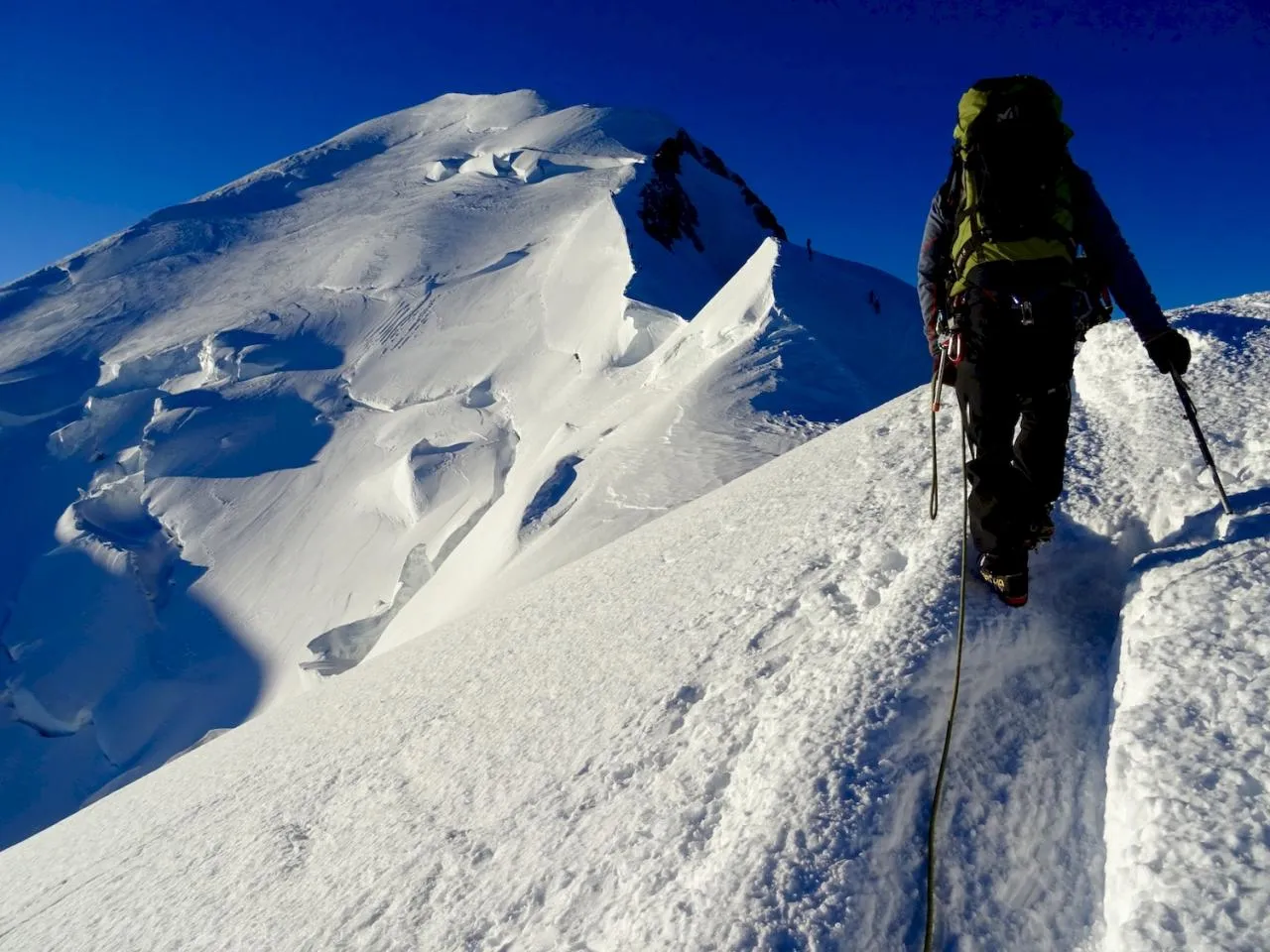
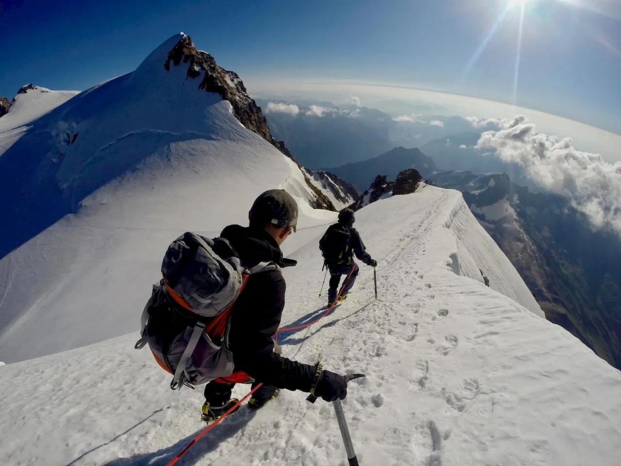
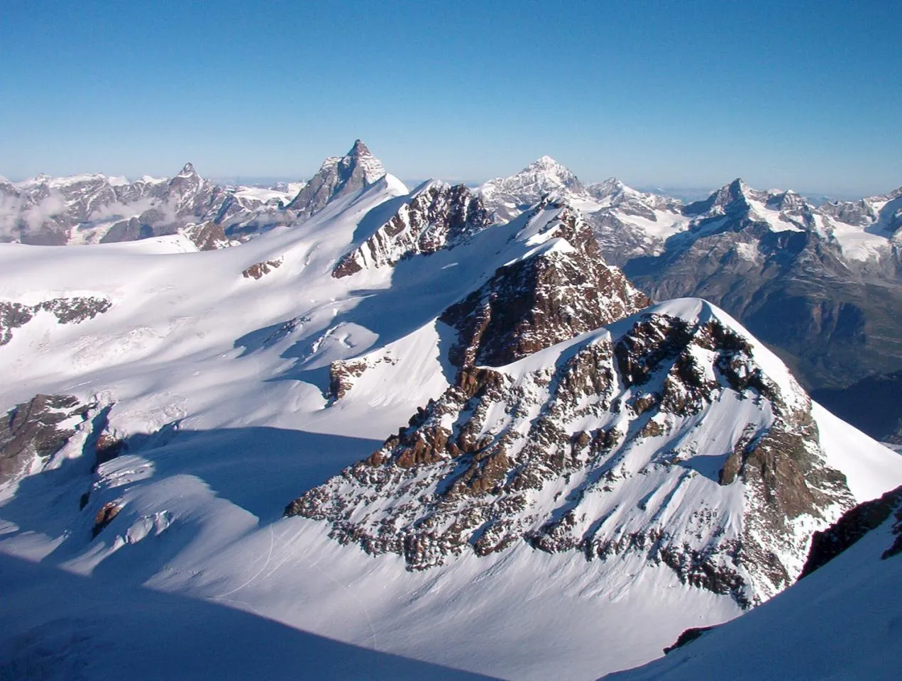
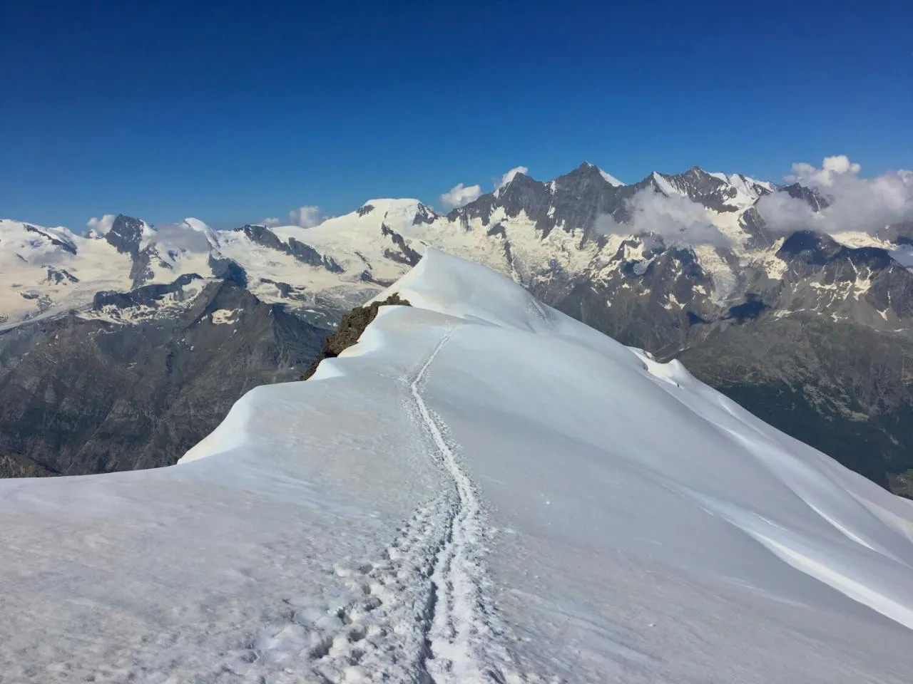
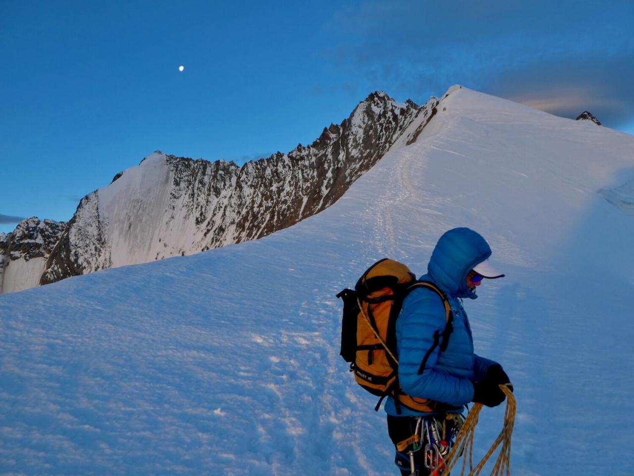
After a restful night, we will start this long and beautiful day. The route climbs gradually towards the Tiefmatten glacier, where we enter a mineral and wild universe. The ascent to Tête Blanche (3710 m) requires good physical condition and experience of high mountains, as it involves crossing crevassed glaciers requiring the use of crampons and ropes. Once at the summit, the reward is immense: a breathtaking panoramic view of the Matterhorn, the Dent d'Hérens and the many peaks of the Valais Alps.
The descent to the Cabane de Bertol (3311 m) is equally impressive, with a route that winds its way through the Mont Miné glacier. The final approach to the refuge is particularly iconic, as it ends with a steep climb and a series of metal ladders fixed to the rock face, adding an adrenaline-fuelled touch to the adventure. Perched on a rocky outcrop, the Cabane de Bertol offers an exceptional view of the surrounding glaciers and is a strategic resting point for mountaineers and hikers on more ambitious expeditions.
Elevation gain: + 1100 m / - 1500 m
Duration: approx. 6 to 7 hours
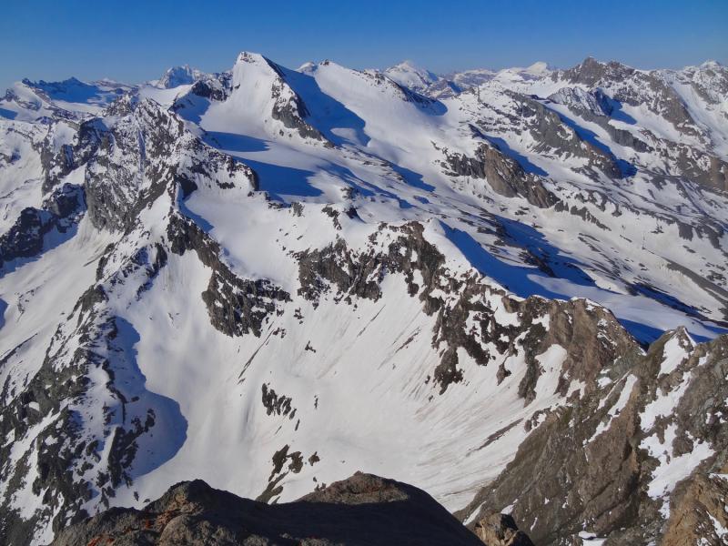
We continue our journey with this new day that takes us to the Pointes d'Oren. We cross the border between Switzerland and Italy in the heart of the Valais Alps. From the Cabane de Bertol, the route begins with a descent to the Mont Miné glacier before gradually climbing up to the Col de l'Évêque (3392 m). Crossing this glacial landscape requires a good command of roped walking and the use of crampons, as progress is made on surfaces that are often snowy or icy. The final ascent to the Pointes d'Oren (3525 m) requires sustained effort, but is rewarded with a breathtaking view of the Mont Blanc massif, the Dent d'Hérens and the immense glacial expanses of the two Alpine slopes.
From the summit, the descent to the Rifugio Nacamuli (2783 m) takes you across the Oren glacier, offering a beautiful panoramic crossing with a succession of snowfields and rocky moraines.
Elevation gain: +/- 1100 m
Duration: approx. 5 to 6 hours
From the start at Rifugio Nacamuli, perched at 2783 metres, the route offers total immersion in a mineral and glacial universe. The route begins with a first technical section through scree and rocky slopes where balance and vigilance are essential. Gradually, the trail becomes more comfortable as it loses altitude, giving way to vast mountain pastures punctuated by glacial streams and ancient moraines.
Then, the climb to the Col de Valcornière (3,067 m) is a demanding hike. As you gain altitude, the vegetation disappears, giving way to rockier and sometimes snowy terrain. The last few metres before the pass are steep and technical, requiring surefootedness on the scree. Once at the summit, the effort is rewarded with a spectacular panorama of the surrounding ridges and the wild immensity of the high mountains. We will end the day with a descent to our next refuge.
Elevation gain: + 1650 m / - 1200 m
Duration: approximately 7 to 8 hours
We have a very varied day on the programme, which consists of a spectacular alpine crossing linking the Aosta Valley to the famous Theodul Pass, at the gateway to Switzerland. We start with the descent towards the Finestra di Cignana (2,448 m), following a sometimes technical alpine route, crossing rocky terrain and steep slopes. As we approach the Finestra di Cignana, the trail becomes more pleasant, offering panoramic views of the Cignana valley.
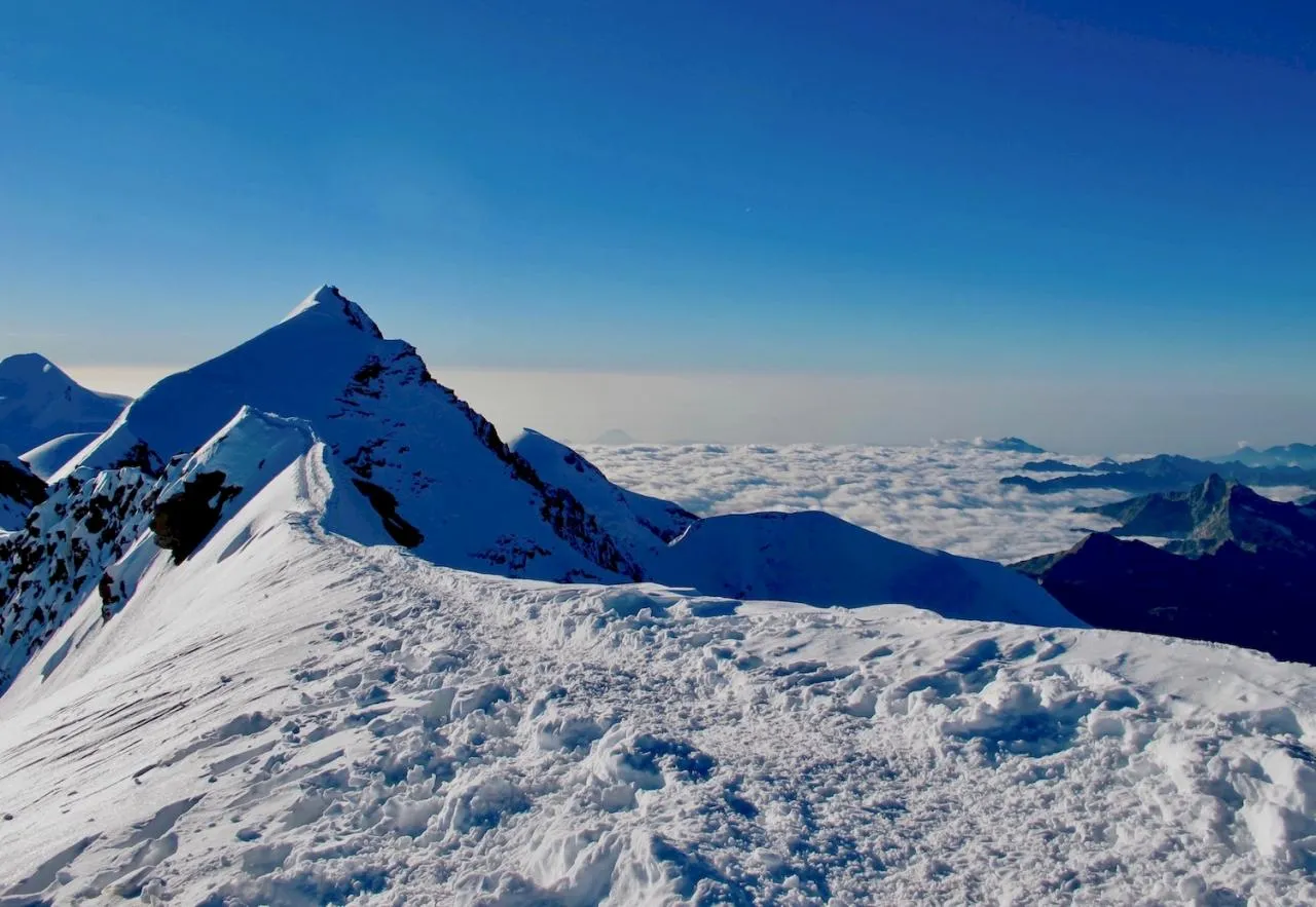
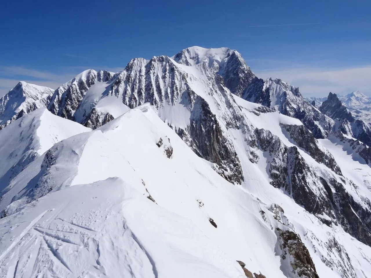
The second part of the route gradually leads to the Plateau Rosa and the Theodul Glacier, with increasingly impressive views of the Matterhorn and the high peaks of the Valais. Rocky terrain and persistent snowfields add an extra challenge.
The arrival at Rifugio Teodulo (3317 m), perched on a historic pass, marks the entrance into a high-altitude world where eternal snows rub shoulders with the history of the first mountaineers. This emblematic refuge, located on the mythical Haute Route linking Chamonix to Zermatt, is the ideal place for a well-deserved break, offering a unique setting between Italy and Switzerland.
Elevation gain: - 1700 m
Duration: approximately 6 to 7 hours
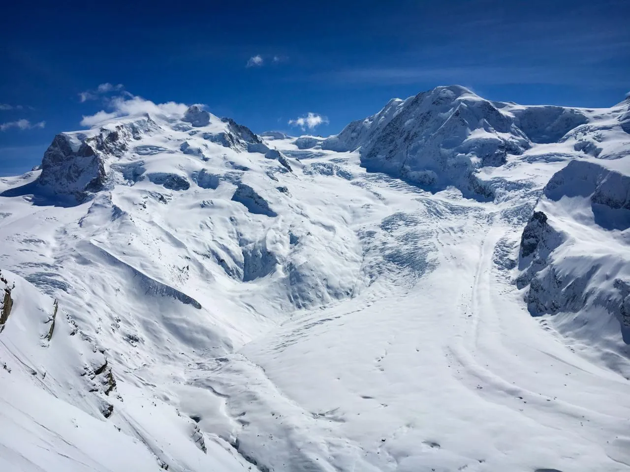
This last day of trekking is a spectacular descent that offers a unique blend of glacial landscapes and breathtaking alpine panoramas. From the refuge, perched at an altitude of 3317 metres, the route begins with a crossing of the Théodule glacier, where you will find yourself in the heart of an immaculate setting with a breathtaking view of the Matterhorn and the surrounding Swiss peaks. The descent continues towards Trockener Steg (2939 m), a rocky plateau offering a striking contrast between ice and rock, with the vast glacial expanses of Monte Rosa and Breithorn as a backdrop. This passage is a true immersion in the world of the high mountains, where each bend reveals an ever more impressive panorama.
After Trockener Steg, the path becomes more accessible, winding through increasingly lush landscapes as you lose altitude. Following the route of the famous Matterhorn Glacier Trail, hikers cross alpine meadows dotted with lakes reflecting the surrounding peaks. Arrival in Zermatt (1608 m) marks the end of an unforgettable adventure, with a gradual immersion in the lively atmosphere of this legendary resort, while the majestic silhouette of the Matterhorn remains in the background.
Materiel
If possible, choose a lightweight rucksack with a good carrying system; the rucksack may not weigh more than 1.5 kilos.
Your rucksack may have 10 to 15 litres of space for the food that you will carry for lunch and sometimes the next day, which the refuges or guide will give you.
Allow 2 litres of water and 500 grams of food for the day.
Your guide will have a more comprehensive first aid kit in case of a more serious accident.
A little treat: a small book or pack of cards (less than 150 grams)...
Weight is the hiker's enemy, but a frozen or soaked hiker is a hiker without pleasure!
So take the time to prepare your rucksack well and weigh it before leaving to check that without water or food your bag weighs 6 to 7 KG but no more!
PLEASE NOTE: if a person is not properly equipped and dressed, the mountain guide may decide not to allow them to participate in the ascent. We ask you to carefully read the equipment list provided in the PDF programme of the activity and to call us if in doubt.
Level
SPORTY & TRAINED PEOPLE:
Effort corresponding to approximately 1200 - 1700m of ascent per day.
You like and practice endurance sports at a good level.
FAIRLY EASY MOUNTAINEERING:
You should be comfortable walking in the mountains and on varied terrain. Easy climbing. If you have already done a glacier trek, it is better, but not compulsory, if you have a good physical and mental condition. Learning the techniques of progression at altitude for fairly easy routes and easy rescue techniques.
Useful info
You can easily reach Zermatt by train (we recommend this for this trek, to limit parking costs in Switzerland and make the return journey easier).
Alternatively, you can park near Zermatt station, but be sure to check the parking fee, which can be quite expensive.
Find timetables and online ticket purchase on Postauto.ch.
Meet on the first day at Zermatt station at 8.30 am where you will meet your guide who will give you information about the trip and quickly check the equipment before starting the trek.
In Zermatt at around 15:00.
For groups of up to 4 participants, the group will be guided by a mountain guide.
For groups of between 5 and 8 participants, the group will be guided by a mountain guide and a mountain leader.
Cancellation and repatriation insurance is compulsory, as is another insurance policy covering mountain search and rescue (approximately 10,000 Euros of cover). The trek takes place in Switzerland and Italy. In the event of rescue, there is a charge, which can be very high if a helicopter is needed.
Here is the insurance that Esprit Montagne offers: https://www.assurance-multi-sports.com.
When you register online, you can choose whether or not you would like to car-share to get to the starting point of your course. After you have made your booking, when you log back into your personal Esprit Montagne account, a section dedicated to car-sharing will be available. You will find the contact details of the participants on your course who are interested in car-sharing, allowing you to get in touch with them directly.
. Guidance from our IFMGA Mountain Guide and his expenses for accommodation and meals.
. Half board in a refuge.
. Picnics from D2 to D6.
. Compulsory transport in the program of activities
. Cancellation/interruption of stay/loss of luggage insurance and emergency assistance.
. Picnic on day 1.
. Drinks and personal expenses.
. Tips.
. Anything not mentioned in the ‘The price includes’ section
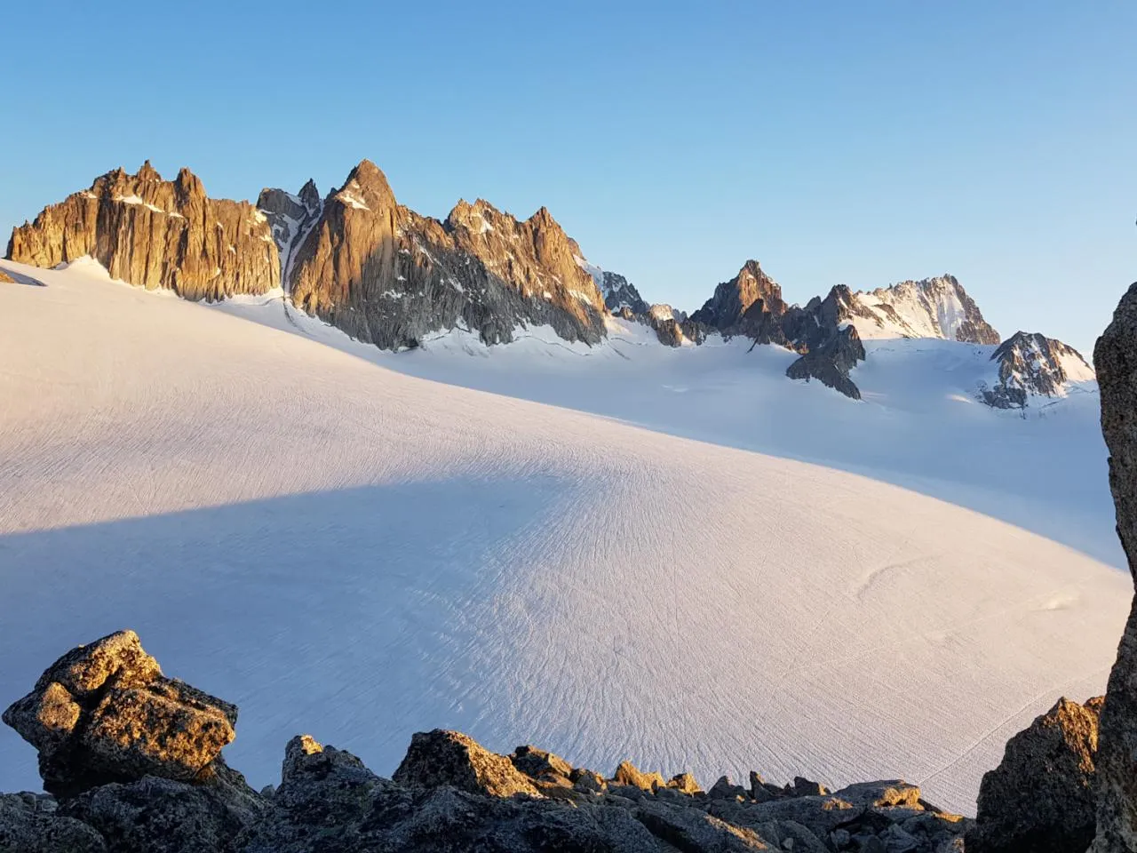
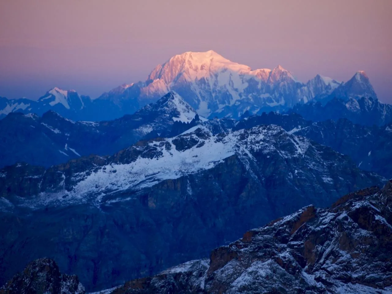
Photo gallery

You will also love

5 days
2580
.webp)
4 days & 3 nights
1730
3 days & 2 nights
1730
4 days & 4 nights
1000

2 days & 1 Nights
530

2 days
260

2 days
550

2 days & 1 night
490
4 days & 3 nights
980

2 days
620
4 days & 3 nights or 5 days & 4 nights
1770

3 days and 2 nights
1085
2 days
690
2 days
810
3 days & 2 nights
1200
2 days & 1 night
970
3 days and 2 nights
2850
4 days
1175
3 days
940
3 days & 2 nights
660
4 days & 3 nights
1050
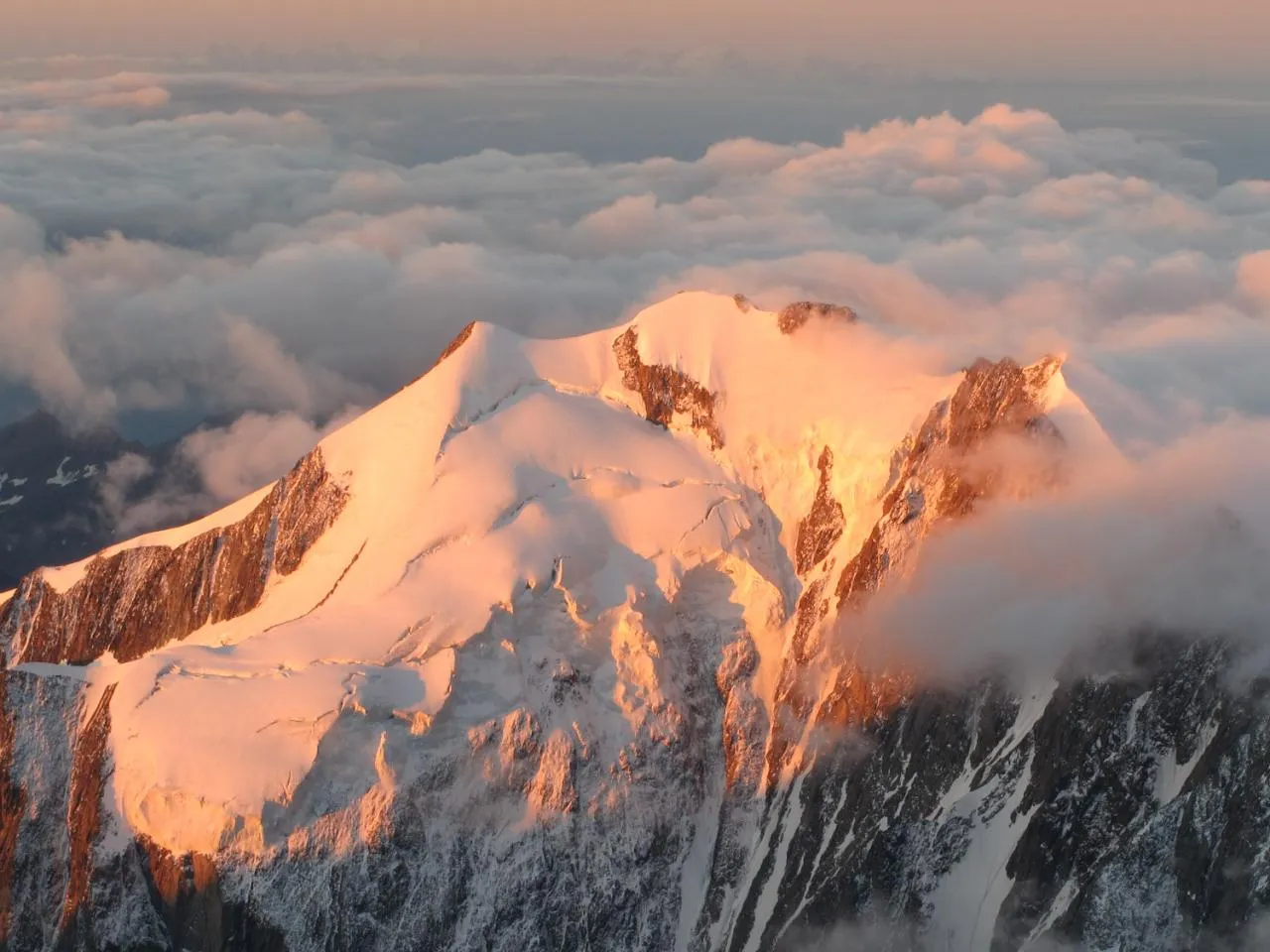
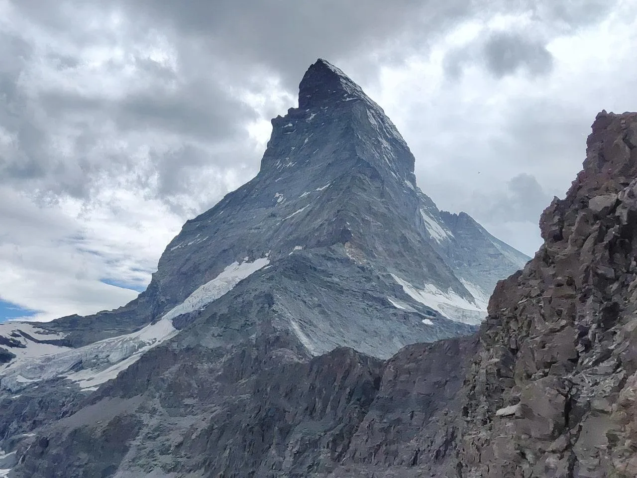
The Matterhorn, at 4,478 metres above sea level, is one of the most iconic and feared mountains in the Alps. Its ascent is considered difficult due to its steep slope, its technical passages and the often unpredictable weather conditions. Although the normal route via the Hörnli ridge is the most accessible, it remains demanding, requiring excellent physical condition, extensive mountaineering experience and a mastery of rock climbing. The exposed terrain, combined with fatigue and altitude, increases the risks, making the Matterhorn an ascent reserved for experienced mountaineers.
In addition to the technical challenges, the Matterhorn is also dangerous because of the high number of visitors, which causes rockfalls and traffic jams on the route. Every year, accidents occur, sometimes fatal, reminding us that this mountain should never be underestimated. To maximise the chances of success, it is advisable to train rigorously, to acclimatise to the altitude and, if necessary, to call on the services of a mountain guide. In short, although the Matterhorn is legendary and accessible to experienced mountaineers, it remains a demanding climb where preparation and caution are essential.
The first ascent of the Matterhorn was made on 14 July 1865 by a team led by the British mountaineer Edward Whymper. Accompanied by six other climbers, including the Swiss guide Peter Taugwalder and his son, as well as the French guide Michel Croz, Whymper succeeded in reaching the summit via the Hörnli ridge on the Swiss side. This ascent made mountaineering history, as the Matterhorn was one of the last great peaks of the Alps to be conquered. However, this success was overshadowed by tragedy: during the descent, four members of the expedition fell to their deaths, leaving a dramatic memory of this first conquest.
Whymper's achievement sparked a wave of enthusiasm for mountaineering and reinforced the Matterhorn's reputation as one of the most formidable mountains. In the days that followed, an Italian team led by Jean-Antoine Carrel also succeeded in climbing the mountain, but via the Lion Ridge on the Italian side. This simultaneous success emphasised the rivalry between British and Italian mountaineers at the time. Since this historic first ascent, the Matterhorn has become a legendary peak, attracting hundreds of mountaineers every year who wish to follow in the footsteps of Whymper and his companions.
The Haute Route is a high mountain route linking Chamonix in France to Zermatt in Switzerland. This legendary route, travelled in both summer for hiking and winter for ski touring, passes through some of the most beautiful alpine landscapes, crossing glaciers, high passes and impressive peaks. Created in the 19th century by British mountaineers, the Haute Route is now a popular adventure for mountain lovers looking for an immersive experience in the heart of the Alps. The classic route covers about 180 kilometres and takes between 6 and 10 days of effort, with stages in refuges or bivouacs.
In winter, the Haute Route is particularly demanding, requiring a good command of ski touring and knowledge of the dangers in the high mountains, such as avalanches and crevasses. In summer, the route becomes a long, sometimes technical, high-altitude hike where endurance and acclimatisation are essential. Although there are several variants, the most famous one passes through emblematic places such as the Col du Chardonnet, the Valsorey hut and the Zmutt glacier. Whether on skis or on foot, the Haute Route is an unforgettable adventure, offering spectacular panoramas and a real physical challenge for those passionate about mountaineering and hiking.


