Massimo 5 clienti per guida, ma può essere ridotto a 3 a seconda del corso e delle condizioni della montagna.
È necessario essere a proprio agio nelle camminate in montagna e su terreni variegati. Camminata facile con i ramponi sul ghiacciaio.
Se avete già fatto un'escursione sul ghiacciaio è meglio, ma non è obbligatorio: se avete una buona forma fisica e una buona gestione mentale, non dovreste avere problemi.
Livello fisico : 4.5 / 5
Livello fisico : 4.5 / 5
Livello intermedio.
Sforzo corrispondente a circa 1400m - 2000m di dislivello.
2 giorni
Partecipanti : 3 to 5
da fine giugno a settembre
Tutto compreso in rifugio
Corso di alpinismo - Arrampicata sul Monte Rosa
Vi proponiamo un percorso che non smette mai di affascinare, attraverso paesaggi favolosi e cime prestigiose del Monte Rosa, un massiccio che rivaleggia con il Monte Bianco per bellezza e magnificenza. La Punta Gnifetti (Signalkuppe), con i suoi 4454 m, è la vetta più...
ALPINISMO FACILE È necessario sentirsi a proprio agio nel camminare in montagna e su terreni vari. Facile utilizzo dei ramponi. Apprendimento delle tecniche di progressione in alta montagna per percorsi abbastanza facili.
Livello fisico : 3.5 / 5
Livello fisico : 3.5 / 5
PERSONE SPORTIVE E ALLENATE Per escursionisti esperti e allenati. Sforzo corrispondente a circa 1000 o 1400 m di dislivello al giorno durante l'escursione. Amate e praticate a buon livello gli sport di resistenza.
2 giorni e 1 notte
Partecipanti : 3 to 5
da fine giugno a settembre
Tutto compreso in rifugio
Weekend di alpinismo
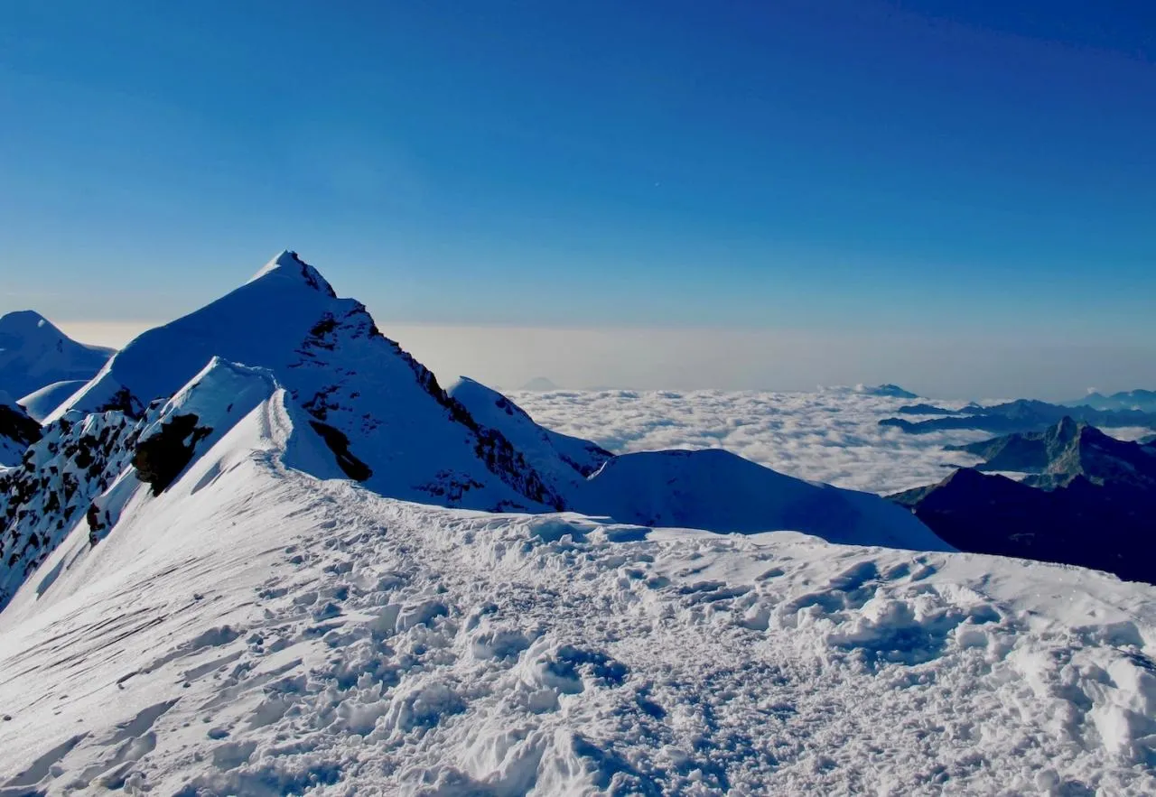
Una splendida prima giornata di trekking per salire tranquillamente al rifugio a 3400 m di altitudine, poi il secondo giorno si parte per la Piramide Vincent per superare i 4000 metri e scoprire il massiccio del Monte Rosa.
Massimo 5 clienti per guida, ma possono essere ridotti a 3 a seconda del corso e delle condizioni della montagna.
È necessario essere a proprio agio nelle camminate in montagna e su terreni variegati. Camminata facile con i ramponi sul ghiacciaio.
Se avete già fatto un'escursione sul ghiacciaio è meglio, ma non è obbligatorio: se avete una buona forma fisica e una buona gestione mentale, non dovreste avere problemi.
Apprendimento della progressione escursionistica in alta montagna, per gare piuttosto facili e tecniche di soccorso semplici.
Esempio di livello: un 4000 facile, come il Gran Paradiso (4061 m) - Parco Nazionale Gran Paradiso.
Livello fisico : 4 / 5
Livello fisico : 4 / 5
Per sportivi allenati. Sforzo corrispondente a circa 1200 - 1700 m di dislivello nel trekking.
Per l'alpinismo: anche se il dislivello è meno significativo, la permanenza in alta quota avrà un effetto significativo sulle prestazioni fisiche abituali.
1 giorno
Partecipanti : Da 3 a 5 persone
da metà giugno a fine settembre
Extra expenses not included
Il Breithorn occidentale fa parte della cresta alpina della catena del Monte Rosa.
È generalmente considerato uno dei 4000 più facili delle Alpi, ma ciò non significa affatto che sia meno bello!
Massimo 5 clienti per guida, ma può essere ridotto a 3 a seconda del corso e delle condizioni della montagna.
È necessario essere a proprio agio nelle camminate in montagna e su terreni variegati. Camminata facile con i ramponi sul ghiacciaio.
Se avete già fatto un'escursione sul ghiacciaio è meglio, ma non è obbligatorio: se avete una buona forma fisica e una buona gestione mentale, non dovreste avere problemi.
Apprendimento della progressione escursionistica in alta montagna, per gare piuttosto facili e tecniche di soccorso semplici.
Esempio di livello: un 4000 facile, come il Gran Paradiso (4061 m) - Parco Nazionale Gran Paradiso.
Livello fisico : 4.5 / 5
Livello fisico : 4.5 / 5
SPORT MOLTO BEN ALLENATO
Sforzo corrispondente a 1500m - 2000m di salita in escursioni.
Vi piacciono e praticate regolarmente sport di resistenza a un buon livello.
4 giorni e 3 notti
Partecipanti : da 3 a 4 max
Da giugno a settembre
All Included
Partendo dal re del Parco Nazionale del Gran Paradiso per terminare con la scalata della Capanna Margherita, il rifugio più alto d'Europa a 4554 metri sulla nota Signalkuppe o Punta Gnifetti.
Massimo 3 a seconda del corso e delle condizioni della montagna.
È necessario essere a proprio agio nelle camminate in montagna e su terreni variegati. Camminare facilmente con i ramponi sul ghiacciaio.
Se avete già fatto un'escursione sul ghiacciaio è meglio, ma non è obbligatorio: se avete una buona forma fisica e una buona gestione mentale, non dovreste avere problemi.
Apprendimento della progressione escursionistica in alta montagna, per gare piuttosto facili e tecniche di soccorso semplici.
Esempio di livello: un 4000 facile, come il Gran Paradiso (4061 m) - Parco Nazionale Gran Paradiso.
Livello fisico : 4 / 5
Livello fisico : 4 / 5
Per sportivi allenati. Sforzo corrispondente a circa 1200 - 1700 m di dislivello nel trekking.
Per l'alpinismo: anche se il dislivello è meno significativo, la permanenza in alta quota per diversi giorni avrà un effetto significativo sulle prestazioni fisiche abituali.
2 giorni
Partecipanti : max 3
Metà giugno metà settembre
Tutto incluso nel rifugio
Uno dei nomi gemelli provenienti dalla mitologia classica che simboleggia l'amicizia: Castore e Polluce sono due bellissime cime gemelle legate dalla loro eterna vicinanza.
Avete esperienza di alpinismo ed escursionismo e avete già effettuato una salita in quota.
Siete a vostro agio nella camminata con i ramponi e nelle escursioni su ghiacciaio, siete in grado di gestire una corda su percorsi facili in quota.
Possibile apprendimento di tecniche più complesse: soccorso, previsioni meteo e cartografia (GPS)...
Esempio di livello:Naso di Lyskam (4272 mT) - Massiccio del Monte Rosa
Livello fisico : 4 / 5
Livello fisico : 4 / 5
SPORT ALLENATO
Sforzo corrispondente a circa 1200 - 1700 m di dislivello al giorno.
Per l'alpinismo: anche se il dislivello è meno significativo, la permanenza in alta quota per diversi giorni avrà un effetto significativo sulle vostre prestazioni fisiche abituali.
Vi piacciono e praticate sport di resistenza a un buon livello.
4 giorni e 3 notti o 5 giorni e 4 notti
Partecipanti : max 3
Da fine giugno a fine luglio per le condizioni migliori
Tutto compreso nella capanna
Lo Spaghetti Tour è una settimana che dovrebbe essere nella lista dei desideri di ogni alpinista. È un viaggio che non delude mai e che probabilmente vi farà tornare indietro per...
Avete esperienza di alpinismo e avete già scalato in quota. Siete autonomi e padroni dell'attività, potete gestire una corda su una via facile in alta montagna.
Livello fisico : 4 / 5
Livello fisico : 4 / 5
PERSONE SPORTIVE E MOLTO ALLENATE
Sforzo corrispondente a 1500m - 2000m di salita in escursioni.
Amate e praticate sport di resistenza a un livello molto buono.
3 giorni e 2 notti
Partecipanti : max 3
da giugno a settembre
Tutto compreso in un rifugio
Un corso di alpinismo di 3 giorni alla scoperta delle cime Polluce e Castore nel cuore del massiccio del Monte Rosa. Vi proponiamo un anello estetico che vi porterà alla scoperta di due valli selvagge delle Alpi italiane.
ALPINISMO CONFERMATO: Avete esperienza di alpinismo e siete già saliti in quota. Siete autonomi e padroni dell'attività, sapete gestire una corda su una via facile in alta montagna. Imparerete tecniche complesse: soccorso, meteo e cartografia (GPS)...
Livello fisico : / 5
Livello fisico : / 5
PERSONE SPORTIVE E ALLENATE: Sforzo corrispondente a circa 1200 - 1700 m di dislivello in salita al giorno. Vi piacciono e praticate sport di resistenza a un buon livello.
2 giorni e 1 notte
Partecipanti : 1 o 2
Luglio e agosto
Tutto compreso nel rifugio
Vivi un'avventura eccezionale con la traversata del Breithorn, che collega il Breithorn Occidentale al Centrale, offrendo panorami mozzafiato e una sfida moderata. Per un'esperienza più breve, la mezza traversata ti porta alla cima del Breithorn Centrale, alla scoperta della bellezza delle Alpi. Un'esperienza indimenticabile, accessibile e ricca di emozioni!
Avete esperienza di alpinismo ed escursionismo e avete già effettuato una salita in quota.
Siete a vostro agio nella camminata con i ramponi e nelle escursioni su ghiacciaio, siete in grado di gestire una corda su percorsi facili in quota.
Possibile apprendimento di tecniche più complesse: soccorso, previsioni meteo e cartografia (GPS)...
Esempio di livello: Naso di Lyskam (4272 mT) - Massiccio del Monte Rosa
Livello fisico : 4 / 5
Livello fisico : 4 / 5
Per gli sportivi allenati, padroneggiate l'attività sportiva del viaggio che acquistate!
Sforzo corrispondente a circa 1200 - 1700 m di dislivello nel trekking.
Per l'alpinismo: anche se il dislivello è meno significativo, la permanenza in alta quota per diversi giorni avrà un effetto significativo sulle vostre prestazioni fisiche abituali.
2 giorni
Partecipanti : max 2
Metà giugno metà settembre
Tutto compreso
La Schneedomsptize, meglio conosciuta come Naso del Lyskamm, fa parte del massiccio del Monte Rosa, lungo il confine italo-svizzero tra Gressoney e Zermatt.
Il Naso di Lyskamm è conosciuto come una delle più belle creste delle Alpi.
Avete un alto livello di competenza nelle tecniche di arrampicata, progressione e soccorso in montagna. Siete a vostro agio nei passaggi aerei sulle creste. Avete già effettuato una scalata di 4000m ed è andata molto bene.
Livello fisico : 5 / 5
Livello fisico : 5 / 5
Siete esperti nell'attività sportiva del viaggio acquistato.
Sforzo corrispondente a 1.700 - 2.500 metri di dislivello al giorno, sforzo intenso richiesto per circa 12 ore.
Siete uno sportivo molto allenato e in buona forma fisica.
3 giorni e 2 notti
Partecipanti : 1
Da giugno a settembre
Tutto compreso nel rifugio
Dufourspitze, con i suoi 4.634 m, è il punto più alto del massiccio del Mont Rose, il secondo più alto delle Alpi. Si tratta di un'ascensione tecnica riservata agli alpinisti più esperti che si sono acclimatati bene e sono allenati e abituati alle tecniche alpinistiche.
ALPINISMO ABBASTANZA FACILE: Dovete essere a vostro agio nel camminare in montagna e su terreni variegati. Arrampicata facile. Se avete già fatto un trekking su ghiacciaio, è meglio, ma non obbligatorio, che abbiate una buona condizione fisica e mentale. Apprendimento delle tecniche di progressione in quota per itinerari abbastanza facili e delle tecniche di soccorso facili.
Livello fisico : 4 / 5
Livello fisico : 4 / 5
PERSONE SPORTIVE E ALLENATE: Sforzo corrispondente a circa 1200 - 1700 m di dislivello in salita al giorno. Vi piacciono e praticate sport di resistenza a un buon livello.
6 giorni
Partecipanti : 4 a 8
luglio
Rifugio in montagna
Vivi un'esperienza indimenticabile nel cuore delle Alpi con un tour del Cervino di 6 giorni, con partenza da Zermatt. Questo eccezionale trekking ti porta alla scoperta di paesaggi spettacolari, tra maestosi ghiacciai, verdi alpeggi e passi di alta montagna che offrono panorami mozzafiato. Ogni tappa è un'immersione totale nel mondo alpino, attraverso la Svizzera e...
Questo corso di alpinismo vi porterà alla scoperta del massiccio del Monte Rosa, per un allenamento e un acclimatamento ideali all'alta quota, per arrivare pronti a scalare il Monte Bianco alla fine della settimana!
A partire da3000
Alpinismo sul Monte Rosa tra Svizzera e Italia
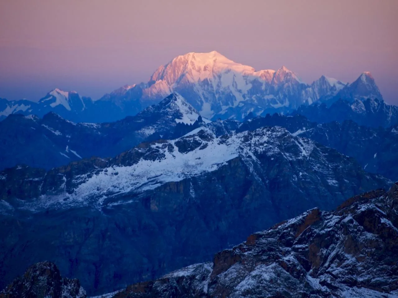
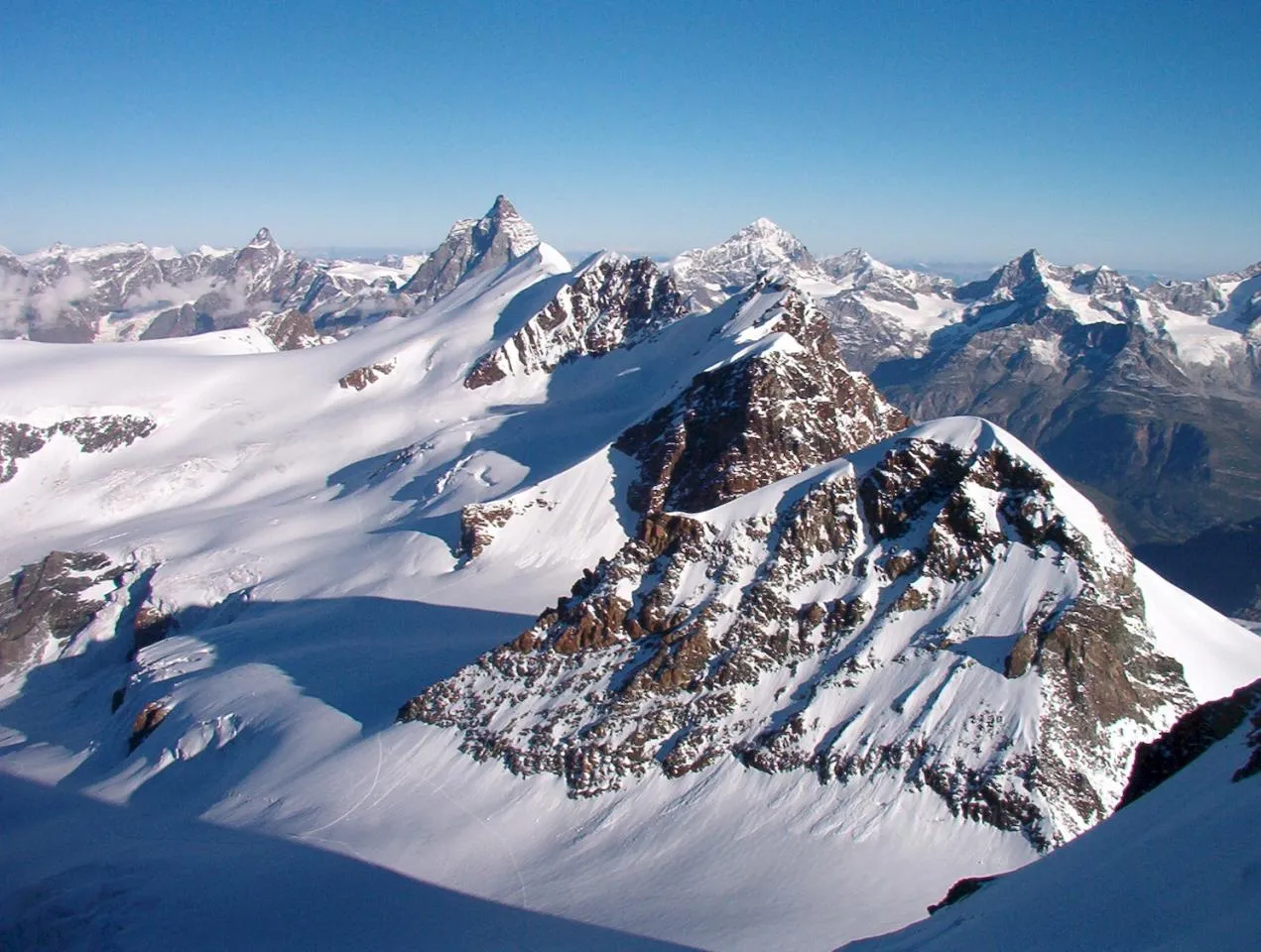
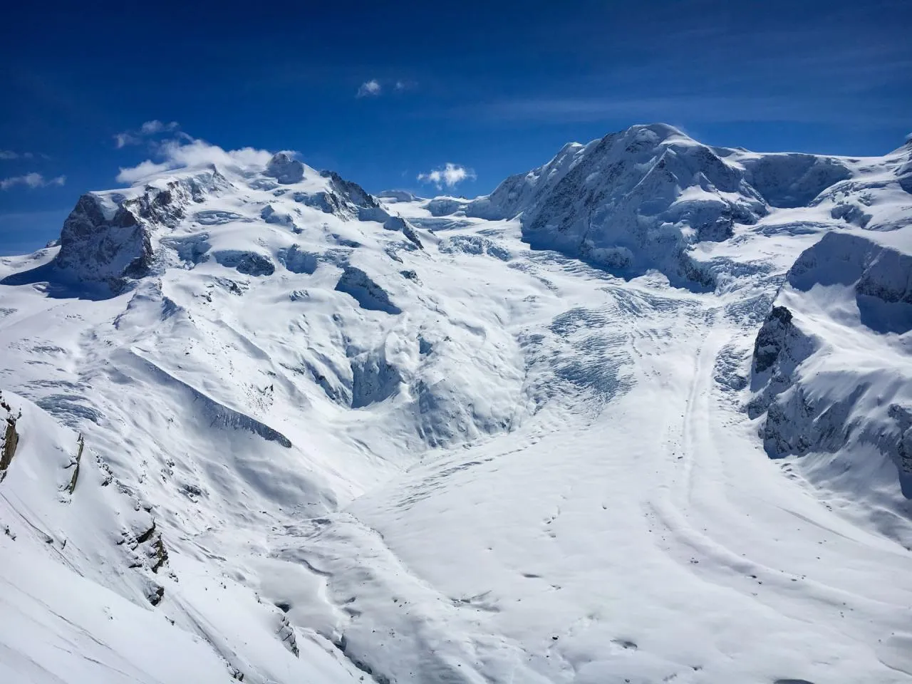
Il Monte Rosa è il secondo massiccio più alto d’Europa dopo il Monte Bianco; la Dufourspitze, a 4634 m, è la vetta più alta della Svizzera…
Situazione geografica del Monte Rosa
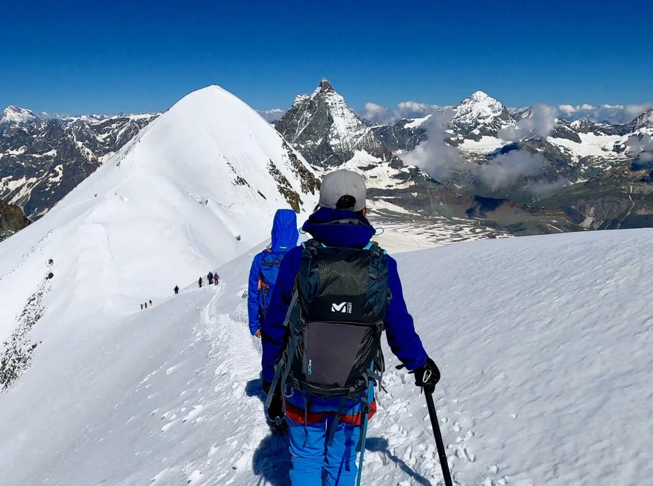
Il massiccio del Monte Rosa si trova al confine tra Italia e Svizzera, tra il Cervino (4468 m) e la vetta del Weissmies (4035 m) in territorio svizzero.
È accessibile sia dal versante svizzero del Vallese, sia dal versante italiano, attraverso la Valle d’Aosta e le valli piemontesi di Alagna e Macugnaga.
Le vette del massiccio del Monte Rosa
Dufourspitze (Punta Dufour) – 4634 m, terza vetta più alta delle Alpi
Punta Dunant – 4632 m
Nordend – 4608 m
Zumsteinspitze (Punta Zumstein) – 4562 m
Piramide Vincent – 4215 m
Castore – 4228 m
Polluce – 4092 m
Lyskamm – 4527 m
Punta Gnifetti (Signalkuppe) – 4554 m
Dufourspitze (Punta Dufour)
È la vetta più alta della Svizzera (4634 m), chiamata così in onore del generale Guillaume Henri Dufour.
La prima ascensione risale al 1° agosto 1855, effettuata da Charles Hudson e dai fratelli Smyth.
Punta Gnifetti (Signalkuppe)
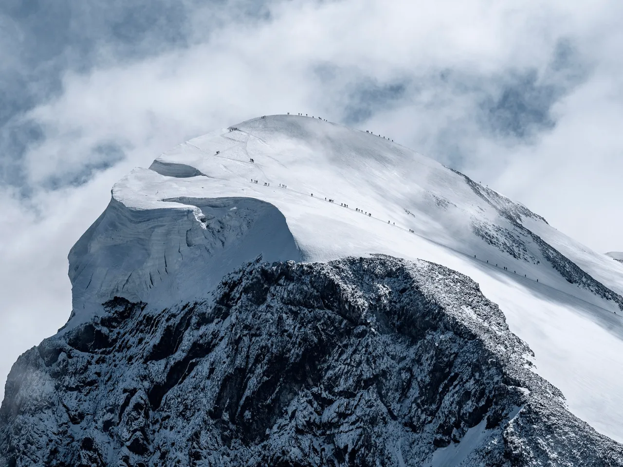
È una delle vette più accessibili oltre i 4500 metri nelle Alpi. Le guide alpine possono accompagnare gruppi fino in cima.
In vetta si trova la Capanna Margherita, il rifugio più alto d’Europa, dove è possibile anche mangiare “la pizza più alta d’Europa” dopo la salita.
Rifugi del Monte Rosa
Rifugio Città di Mantova (3498 m)
Rifugio confortevole e punto di acclimatamento ideale. Raggiungibile facilmente da Gressoney o Alagna tramite impianti fino a Punta Indren.
Rifugio Capanna Gnifetti (3647 m)
Grande rifugio (176 posti), situato su un affioramento roccioso vicino ai ghiacciai. Punto strategico per le ascensioni ai 4000 del Monte Rosa.
Capanna Margherita
Rifugio più alto d’Europa, inaugurato nel 1893 dalla regina Margherita di Savoia. Ospita anche una stazione meteorologica e un centro di ricerca.
Rifugio Quintino Sella
Situato sul percorso della traversata del Monte Rosa (Spaghetti Tour), ai piedi dei ghiacciai di Castore e Polluce.
Il Monte Rosa
È il secondo massiccio più alto delle Alpi dopo il Monte Bianco e uno dei più vasti sistemi glaciali d’Europa, con numerose vette sopra i 4000 metri.
Le valli del Monte Rosa
Valle d’Aosta
Valtournenche (Cervinia)
Val d’Ayas (Champoluc)
Valle del Lys (Gressoney)
Piemonte
Valle di Macugnaga
Valle di Alagna (Walser)
Svizzera
Valle di Zermatt
Valle di Saas
La traversata del Monte Rosa
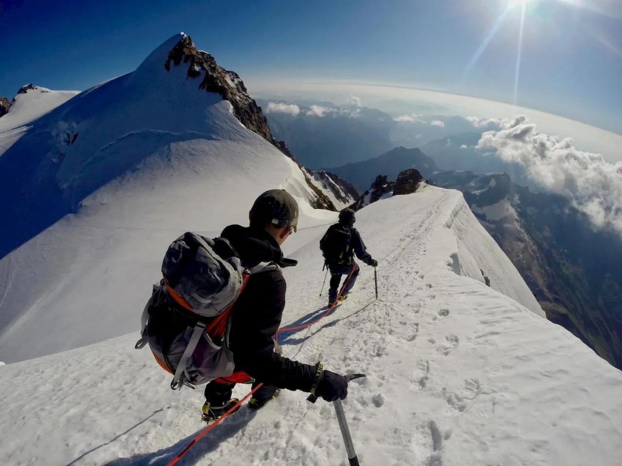
La traversata del Monte Rosa (detta anche Spaghetti Tour) è uno dei più spettacolari itinerari alpinistici delle Alpi, con passaggi su numerosi 4000.
Valle d’Aosta
Regione autonoma italiana dove si parlano italiano e francese, oltre al patois locale. Dopo la Seconda Guerra Mondiale ha ottenuto uno statuto speciale che tutela la sua identità bilingue.